MyTopo
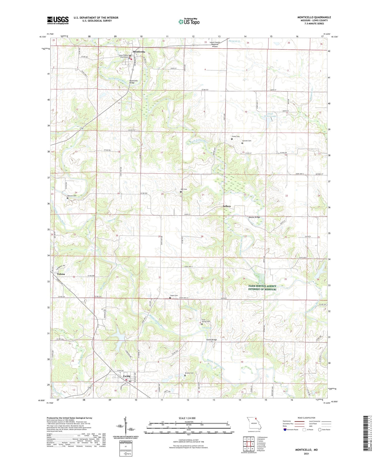
Monticello Missouri US Topo Map
Couldn't load pickup availability
2021 topographic map quadrangle Monticello in the state of Missouri. Scale: 1:24000. Based on the newly updated USGS 7.5' US Topo map series, this map is in the following counties: Lewis. The map contains contour data, water features, and other items you are used to seeing on USGS maps, but also has updated roads and other features. This is the next generation of topographic maps. Printed on high-quality waterproof paper with UV fade-resistant inks.
Quads adjacent to this one:
West: Lewistown
Northwest: Williamstown
North: Benjamin
Northeast: Canton
East: La Grange
Southeast: Maywood
South: Durham
Southwest: Nelsonville
This map covers the same area as the classic USGS quad with code o40091a6.
Contains the following named places: Bancert Cemetery, Betsy Branch, Briscoe Cemetery, Cason Cemetery, City of Ewing, Cool Spring Cemetery, Cool Springs, Cool Springs Church, Durgen, Durgens Creek Post Office, Durgens Creek Watershed Dam Number 28, Ewing, Ewing Dam, Ewing Lake, Ewing Post Office, Finley Cemetery, Garnett Cemetery, Gilead, Gilead Church, Gilead School, Lewis County, Lewis County Sheriff's Office, Lloyd Wilson Lake, Monticello, Monticello Bridge, Monticello Post Office, Monticello Volunteer Fire Department, Nall Cemetery, Otter Branch, Pleasant Hill School, R - 4 Fire Protection District Station 1 Headquarters, Sellers, Selton School, Steele Bridge, Ten Mile, Ten Mile Church, Ten Mile School, Tolona, Township of Dickerson, Village of Monticello, Weston Bridge