MyTopo
New Haven Missouri US Topo Map
Couldn't load pickup availability
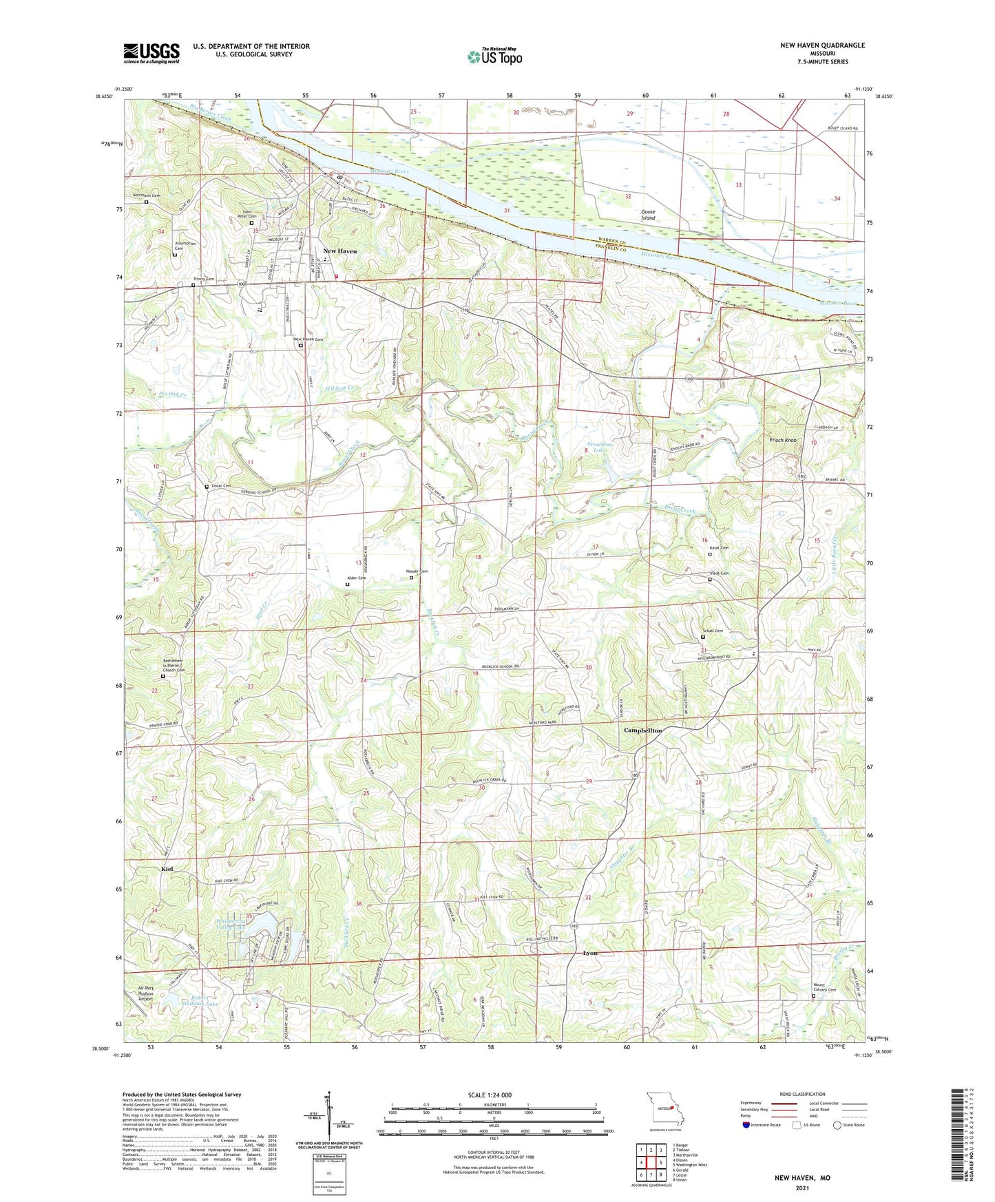
2021 topographic map quadrangle New Haven in the state of Missouri. Scale: 1:24000. Based on the newly updated USGS 7.5' US Topo map series, this map is in the following counties: Franklin, Warren. The map contains contour data, water features, and other items you are used to seeing on USGS maps, but also has updated roads and other features. This is the next generation of topographic maps. Printed on high-quality waterproof paper with UV fade-resistant inks.
Quads adjacent to this one:
West: Dissen
Northwest: Berger
North: Treloar
Northeast: Marthasville
East: Washington West
Southeast: Union
South: Leslie
Southwest: Gerald
Contains the following named places: Air Port Hudson Airport, Alder Cemetery, Assumption Cemetery, Baltimore School, Baltimore Settlement, Bethlehem Lutheran Church, Bethlehem Lutheran Church Cemetery, Big Berger Creek, Boeuf Creek, Boeuf Island, Boeuf Island School, Bucklick Creek, Bucklick School, Campbellton, Campbellton School, Cedar Cemetery, City of New Haven, Deppermann Lake Dam, Enoch Knob, Gerding School, Goose Island, Kasel Cemetery, Kent, Kiel, Little Boeuf Creek, Luecker Lake Dam, Lyon, Maupin School, Miller School, Mount Calvary Cemetery, Mud Creek, Nauser Cemetery, New Haven, New Haven Berger Fire Protection, New Haven Cemetery, New Haven Police Department, Newton Lake Dam, Nortmann Cemetery, Pin Oak Creek, Robert Stallman Lake, Saint Peter Cemetery, Schall Cemetery, Schepp Lake Dam, Stallman Lake Dam, Struebbes Dam, Struebbes Lake, Township of New Haven, Trinity Cemetery, United School, Viedt Cemetery, Whispering Valley Lake, Whispering Valley Lake Number 1 Dam, Whispering Valley Lake Number 2 Dam, Whispering Valley Lake Number 3 Dam, Wildcat Creek, Yates School, Yeager Landing, ZIP Code: 63068