MyTopo
Marthasville Missouri US Topo Map
Couldn't load pickup availability
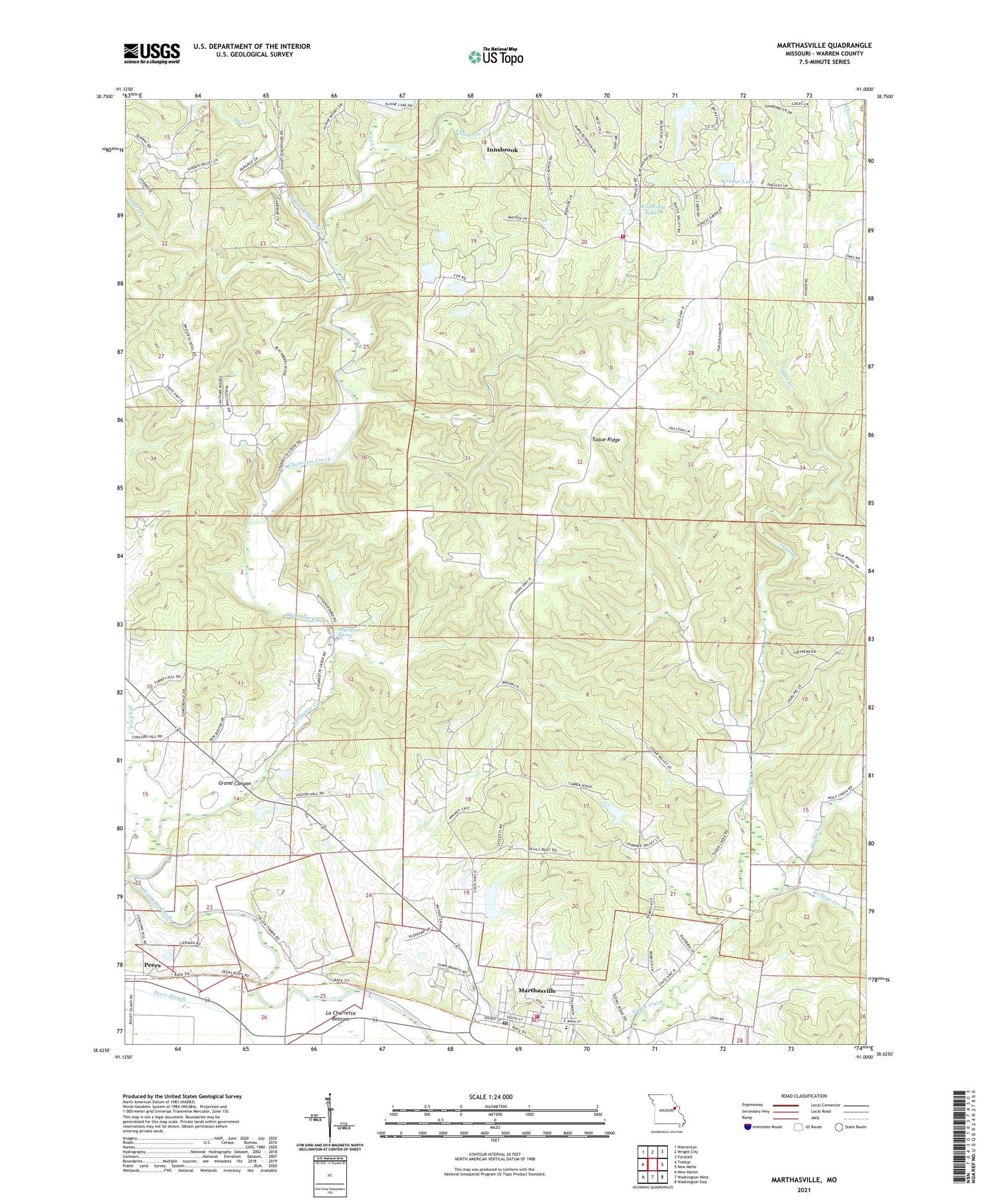
2021 topographic map quadrangle Marthasville in the state of Missouri. Scale: 1:24000. Based on the newly updated USGS 7.5' US Topo map series, this map is in the following counties: Warren. The map contains contour data, water features, and other items you are used to seeing on USGS maps, but also has updated roads and other features. This is the next generation of topographic maps. Printed on high-quality waterproof paper with UV fade-resistant inks.
Quads adjacent to this one:
West: Treloar
Northwest: Warrenton
North: Wright City
Northeast: Foristell
East: New Melle
Southeast: Washington East
South: Washington West
Southwest: New Haven
This map covers the same area as the classic USGS quad with code o38091f1.
Contains the following named places: American Legion Hall, American Legion Park, Brinkman School, Cave Creek, Cedar Grove School, Cedar Valley School, Charrette, City of Marthasville, College Creek, D Bunge Lake Dam, Dry Fork, Dryer School, Engemann Spring, Forest Grove School, Forest Haven Lake Dam, Grand Canyon, H Bunge Lake Dam, Hearse Creek, Koepke Lake North Dam, Koepke Lake South Dam, La Charrette Bottom, Lake of the Woods Dam, Marthasville, Marthasville Elementary School, Marthasville Post Office, Marthasville Volunteer Fire Department Station 1, North Fork Charrette Creek, Owl Creek, Peers, Township of Charrette, Tuque Ridge, Tuque School, Vatterot Dam, Wildwood Lakes, Wolf Creek, Wonder Lake, Wright City Fire Protection District Station 2, ZIP Code: 63357