MyTopo
Shelbyville Missouri US Topo Map
Couldn't load pickup availability
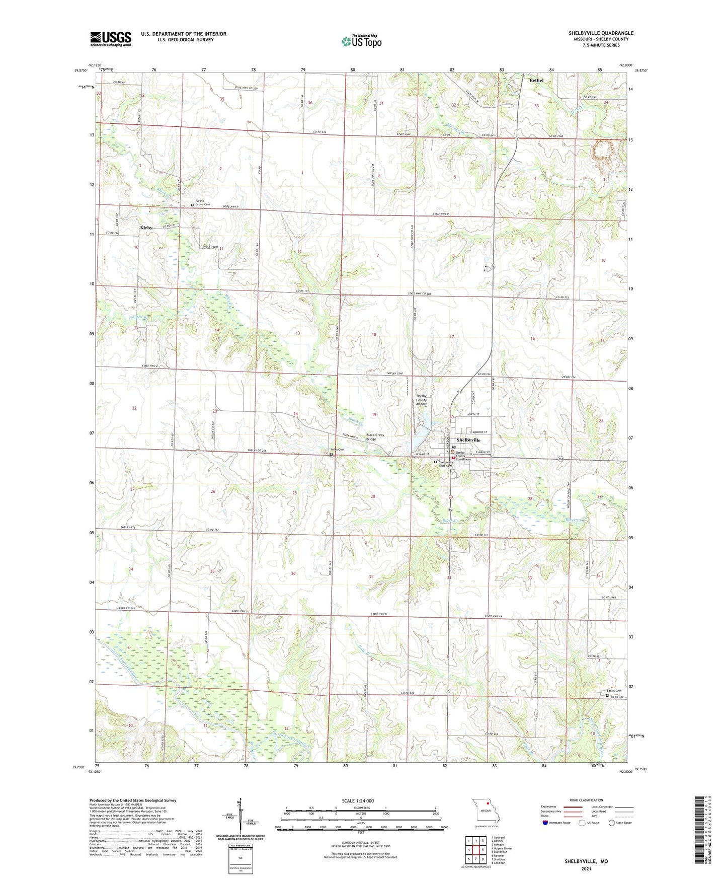
2021 topographic map quadrangle Shelbyville in the state of Missouri. Scale: 1:24000. Based on the newly updated USGS 7.5' US Topo map series, this map is in the following counties: Shelby. The map contains contour data, water features, and other items you are used to seeing on USGS maps, but also has updated roads and other features. This is the next generation of topographic maps. Printed on high-quality waterproof paper with UV fade-resistant inks.
Quads adjacent to this one:
West: Hagers Grove
Northwest: Leonard
North: Bethel
Northeast: Newark
East: Burksville
Southeast: Lakenan
South: Shelbina
Southwest: Lentner
This map covers the same area as the classic USGS quad with code o39092g1.
Contains the following named places: Black Creek Bridge, Bloom Lake Dam, Briggs Branch, City of Shelbyville, Duncan School, Eaton Cemetery, Eaton School, Forest Grove Cemetery, Forest Grove Church, Freeman School, Hale School, Hiles Cemetery, Kirby, Mamre, Mesner Branch, North Shelby High School, Pollard Branch, Robinson School, Rookwood School, Shelby Community Fire Department, Shelby County, Shelby County Airport, Shelby County Sheriff's Office, Shelby High School, Shelbyville, Shelbyville Lake, Shelbyville Lake Dam, Shelbyville Post Office, Township of Black Creek, Trenhaile Lake Dam, ZIP Code: 63469