MyTopo
Bethel Missouri US Topo Map
Couldn't load pickup availability
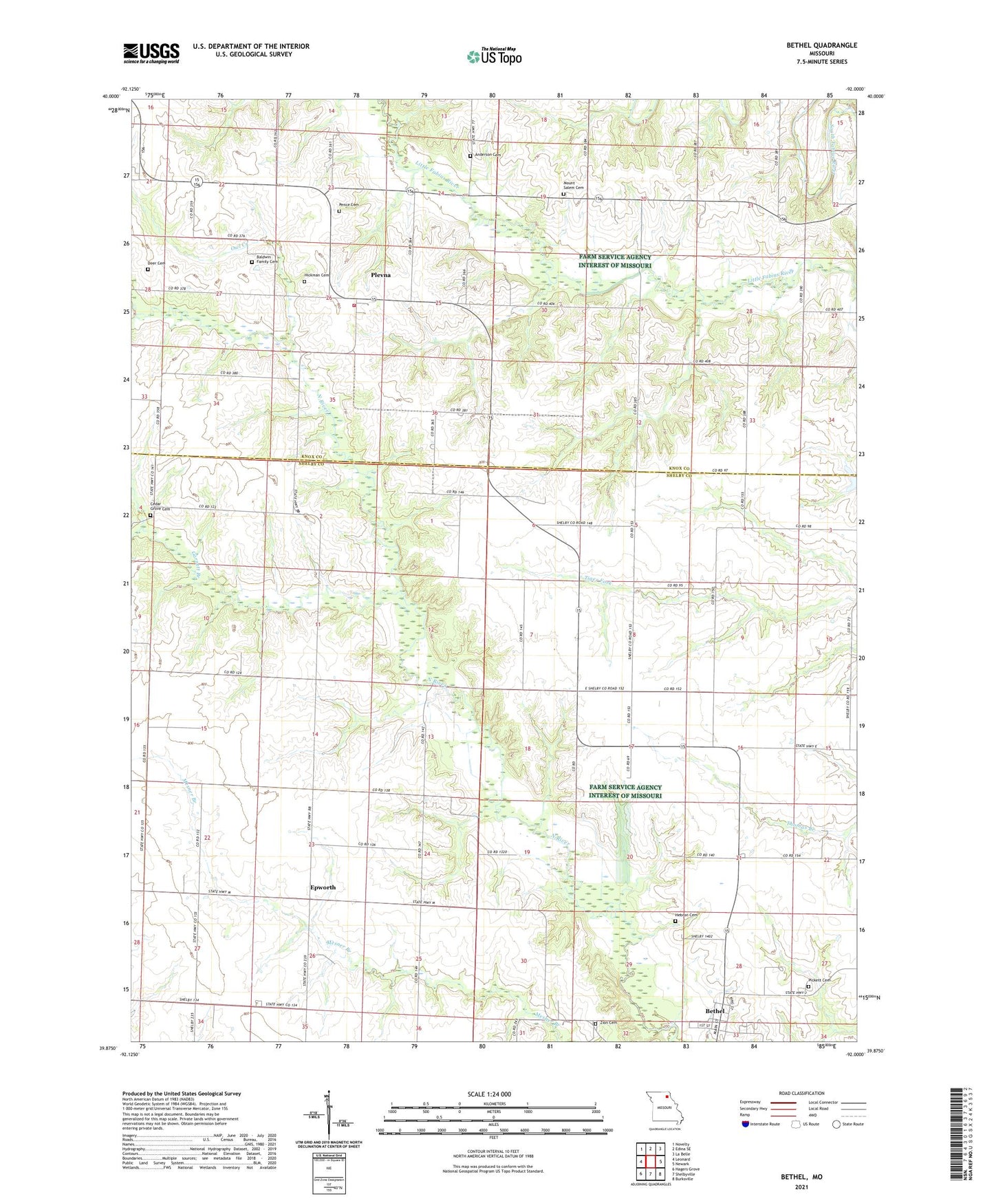
2021 topographic map quadrangle Bethel in the state of Missouri. Scale: 1:24000. Based on the newly updated USGS 7.5' US Topo map series, this map is in the following counties: Shelby, Knox. The map contains contour data, water features, and other items you are used to seeing on USGS maps, but also has updated roads and other features. This is the next generation of topographic maps. Printed on high-quality waterproof paper with UV fade-resistant inks.
Quads adjacent to this one:
West: Leonard
Northwest: Novelty
North: Edina SE
Northeast: La Belle
East: Newark
Southeast: Burksville
South: Shelbyville
Southwest: Hagers Grove
This map covers the same area as the classic USGS quad with code o39092h1.
Contains the following named places: Anderson Cemetery, Applegate School, Baldwin Family Cemetery, Bethel, Brick School, Campbell School, Cedar Grove Cemetery, Day School, Deer Cemetery, Drennan School, Epworth, Epworth Methodist Church, Garnett Branch, Hebron, Hebron Cemetery, Hickman Cemetery, Lost Branch, Mann Lake Dam, Mount Pisgah Church, Mount Pisgah Park, Mount Salem Cemetery, Mount Salem Church, Owl Creek, Palmer Airport, Pence Cemetery, Pickett Cemetery, Pleasant Prairie Church, Plevna, Plevna Census Designated Place, Plevna Post Office, Plevna Rural Fire Department, Short School, Township of Bethel, Township of Bourbon, Township of Fabius, Village of Bethel, Zion Cemetery, Zion Evangelical Church, ZIP Codes: 63458, 63464