MyTopo
Niangua Missouri US Topo Map
Couldn't load pickup availability
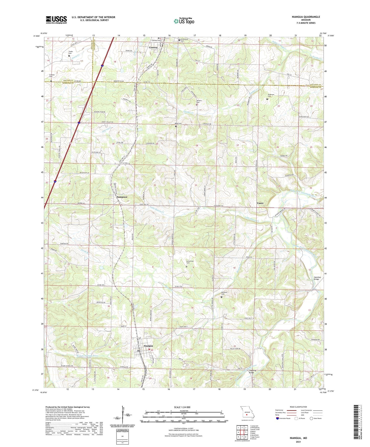
2021 topographic map quadrangle Niangua in the state of Missouri. Scale: 1:24000. Based on the newly updated USGS 7.5' US Topo map series, this map is in the following counties: Webster, Laclede, Dallas. The map contains contour data, water features, and other items you are used to seeing on USGS maps, but also has updated roads and other features. This is the next generation of topographic maps. Printed on high-quality waterproof paper with UV fade-resistant inks.
Quads adjacent to this one:
West: Beach
Northwest: Long Lane
North: Phillipsburg
Northeast: Brush Creek
East: Rader
Southeast: Duncan
South: High Prairie
Southwest: Marshfield
Contains the following named places: Anderson Cemetery, Bowen Creek, Cantrell Creek, City of Niangua, Conway Cemetery, Conway Church, Conway Freewill Baptist Church, Copening Bridge, Copening Church, Copening School, Good Spring Cemetery, Good Spring Church, Graceland Cemetery, Graham Cemetery, Hamilton Bridge, Hendrix Cemetery, Letterman Cemetery, Little Bowen Creek, Macky School, Mathis Church, Niangua, Niangua Fire Department, Niangua Junction, Niangua Post Office, Niangua School, Oak Grove School, Reed Cemetery, Reed School, Salem Springs Creek, Sampson, Tindle Cemetery, Township of Niangua, Township of Union, Vance, Williams Cemetery, Youth Camp, ZIP Code: 65632