MyTopo
Ohio Missouri US Topo Map
Couldn't load pickup availability
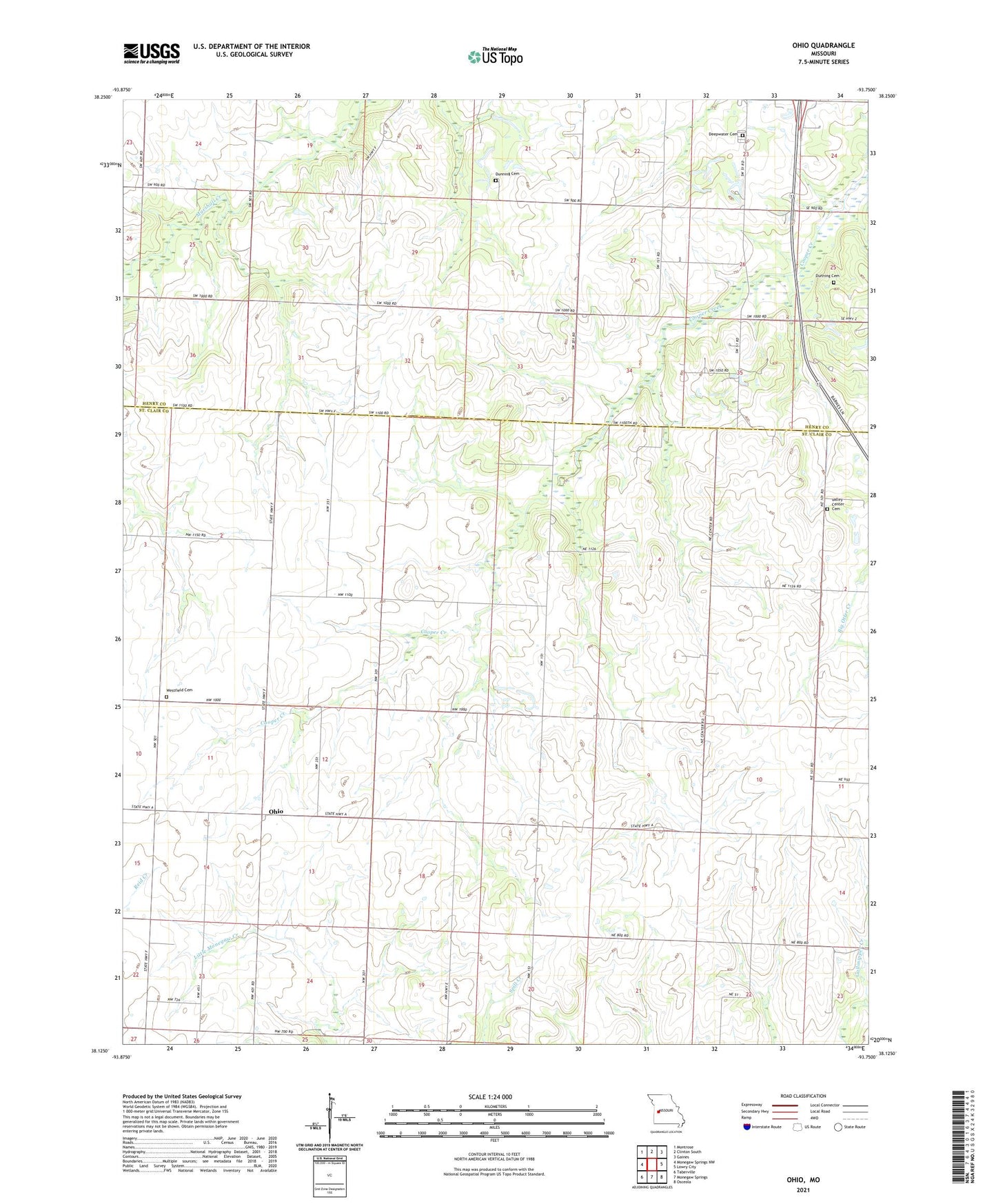
2021 topographic map quadrangle Ohio in the state of Missouri. Scale: 1:24000. Based on the newly updated USGS 7.5' US Topo map series, this map is in the following counties: St. Clair, Henry. The map contains contour data, water features, and other items you are used to seeing on USGS maps, but also has updated roads and other features. This is the next generation of topographic maps. Printed on high-quality waterproof paper with UV fade-resistant inks.
Quads adjacent to this one:
West: Monegaw Springs NW
Northwest: Montrose
North: Clinton South
Northeast: Gaines
East: Lowry City
Southeast: Osceola
South: Monegaw Springs
Southwest: Taberville
Contains the following named places: Deepwater Cemetery, Dunning Cemetery, Glendale School, Grandview School, Harvey Lake Section 17 Dam, Hillsdale School, Little Jewel School, Ohio, Ohio School, Pleasant Valley Church, Schallert Lake Dam, Township of Chalk Level, Township of Fairview, Tranquility School, Trap Branch, Valley Center Cemetery, Valley Center Church, Westfield Cemetery