MyTopo
Gaines Missouri US Topo Map
Couldn't load pickup availability
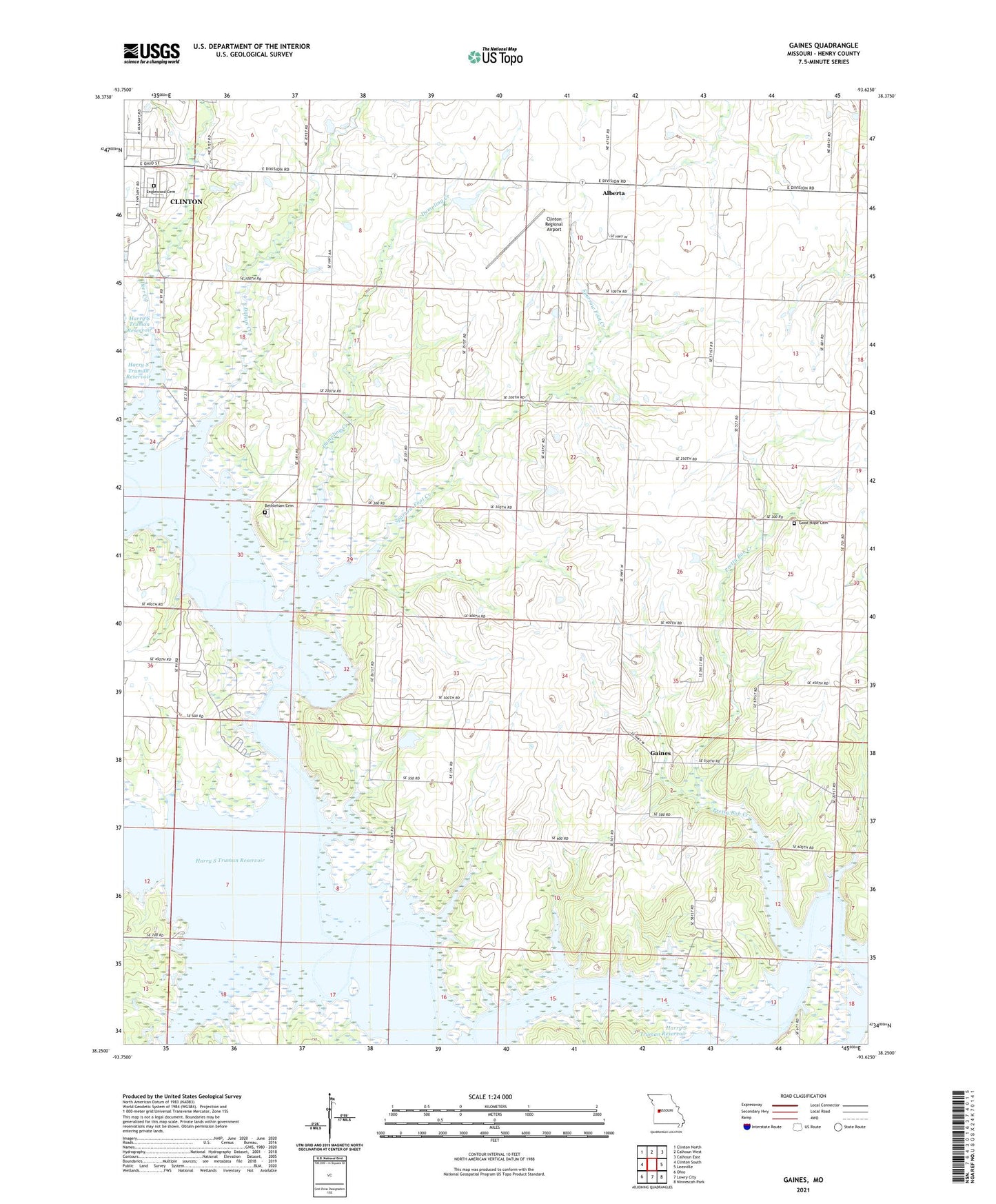
2021 topographic map quadrangle Gaines in the state of Missouri. Scale: 1:24000. Based on the newly updated USGS 7.5' US Topo map series, this map is in the following counties: Henry. The map contains contour data, water features, and other items you are used to seeing on USGS maps, but also has updated roads and other features. This is the next generation of topographic maps. Printed on high-quality waterproof paper with UV fade-resistant inks.
Quads adjacent to this one:
West: Clinton South
Northwest: Clinton North
North: Calhoun West
Northeast: Calhoun East
East: Leesville
Southeast: Ninnescah Park
South: Lowry City
Southwest: Ohio
This map covers the same area as the classic USGS quad with code o38093c6.
Contains the following named places: Alberta, Bethlehem Church, Bethlehem School, Blanchard, Clinton Regional Airport, Cooper Creek, Cooper Creek Public Use Area, Deepwater Creek, Dillion Creek, Dumpling Creek, E Burns Dam, Englewood Cemetery, Freedom School, Gaines, Good Hope Church, Greenridge School, Hay Creek, Hilty Mine, New Harmony School, Pretty Bob Creek, Pretty Bob School, Richland School, Sparrow, Sparrow Foot Creek, Sparrow Post Office, Sparrowfoot Public Use Area, Star School, Stotts Lake Dam, Surprise School, Township of Bethlehem, Wastell Mine, White Lake Dam, ZIP Code: 64735