MyTopo
Florence Missouri US Topo Map
Couldn't load pickup availability
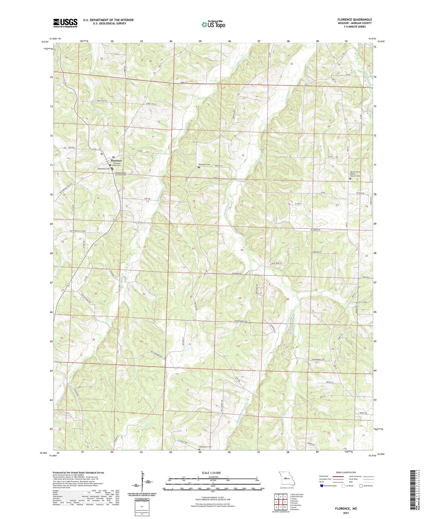
2021 topographic map quadrangle Florence in the state of Missouri. Scale: 1:24000. Based on the newly updated USGS 7.5' US Topo map series, this map is in the following counties: Morgan. The map contains contour data, water features, and other items you are used to seeing on USGS maps, but also has updated roads and other features. This is the next generation of topographic maps. Printed on high-quality waterproof paper with UV fade-resistant inks.
Quads adjacent to this one:
West: Pyrmont
Northwest: Otterville West
North: Otterville East
Northeast: Tipton
East: Fortuna
Southeast: Versailles
South: Stover
Southwest: Crockerville
This map covers the same area as the classic USGS quad with code o38092e8.
Contains the following named places: Bethlehem Cemetery, Bethlehem Church, Big Branch, Bluhm School, Buck Branch, Ebenezer Cemetery, Fire Department Florence Community, Florence, Florence Post Office, Florence Union Cemetery, Lemler School, Little Branch, Lone Oak School, Lone Star School, Methodist Cemetery, Middle Richland Creek, Mount Carmel Baptist Church, Mount Carmel Baptist Church Cemetery, Number 742 Dam, Rocky Point School, Self Chapel School, Township of Mill Creek, Township of Richland, United Church of Christ Cemetery, ZIP Code: 65329