MyTopo
Oxly Missouri US Topo Map
Couldn't load pickup availability
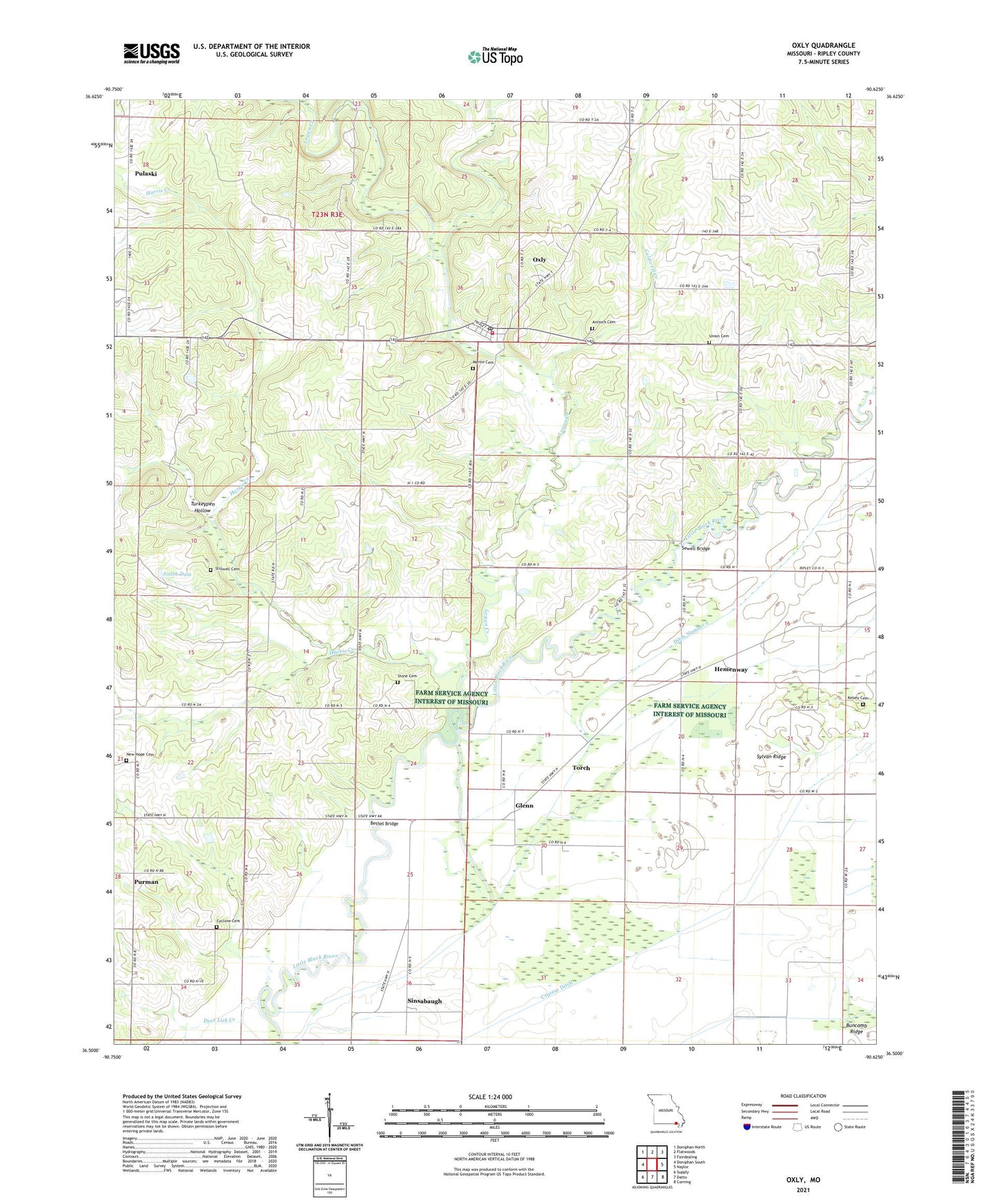
2021 topographic map quadrangle Oxly in the state of Missouri. Scale: 1:24000. Based on the newly updated USGS 7.5' US Topo map series, this map is in the following counties: Ripley. The map contains contour data, water features, and other items you are used to seeing on USGS maps, but also has updated roads and other features. This is the next generation of topographic maps. Printed on high-quality waterproof paper with UV fade-resistant inks.
Quads adjacent to this one:
West: Doniphan South
Northwest: Doniphan North
North: Flatwoods
Northeast: Fairdealing
East: Naylor
Southeast: Corning
South: Datto
Southwest: Supply
Contains the following named places: Acorn Post Office, Acorn School, Antioch Cemetery, Antioch Church, Bethel Bridge, Blue Hole, Caldwell Creek, Cardwell Cemetery, Crossroads School, Current River Country Club, Cyclone Cemetery, Cyclone School, Cypress Creek, Cypress Ditch, Deer Lick Creek, Ditch Number 2, Glenn, Harris Creek, Hemenway, Kelsey Cemetery, Logan Creek, Martin Cemetery, Martinsburg, Mo-Ark Camp, New Hope Cemetery, New Hope Church, Oxly, Oxly Census Designated Place, Oxly Lookout Tower, Oxly Post Office, Oxly Volunteer Fire Department, Poe School, Powell School, Pulaski, Purman, Riga, Sewell Bridge, Sewell School, Sheehan, Sinsabaugh, Smith Dam, Smith Lake Dam, Southeastern Ridge and Basin, Stillwell Cemetery, Stone Cemetery, Sylvan Church, Sylvan Ridge, Sylvan School, Taylor School, Torch, Township of Thomas, Township of Varner, Tucker School, Turkeypen Hollow, Union Cemetery, Venerable School, ZIP Codes: 63953, 63955