MyTopo
Supply Arkansas US Topo Map
Couldn't load pickup availability
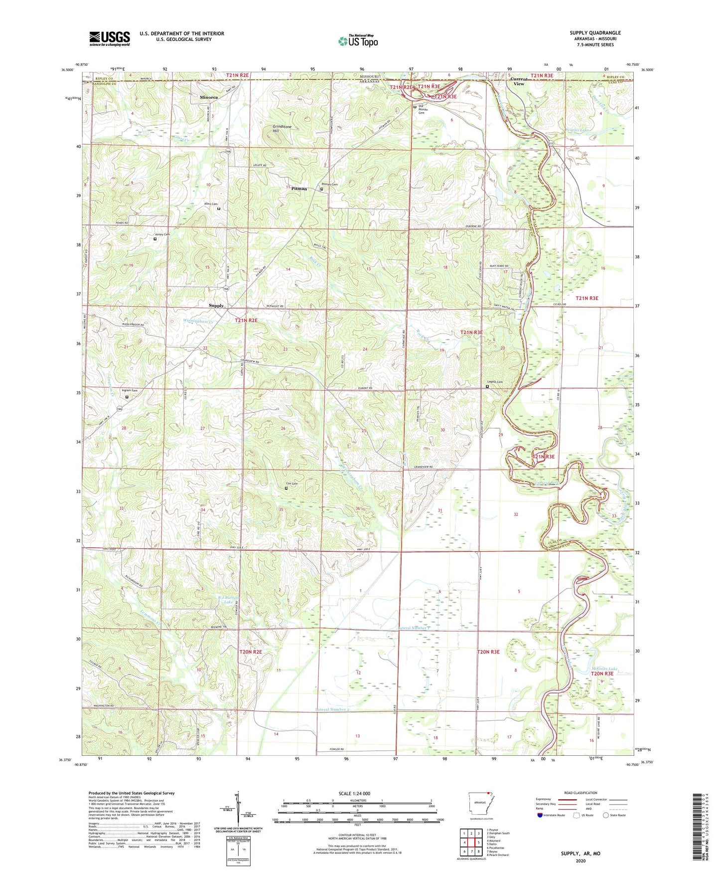
2024 topographic map quadrangle Supply in the state of Arkansas. Scale: 1:24000. Based on the newly updated USGS 7.5' US Topo map series, this map is in the following counties: Randolph, Clay, Ripley. The map contains contour data, water features, and other items you are used to seeing on USGS maps, but also has updated roads and other features. This is the next generation of topographic maps. Printed on high-quality waterproof paper with UV fade-resistant inks.
Quads adjacent to this one:
West: Maynard
Northwest: Poynor
North: Doniphan South
Northeast: Oxly
East: Datto
Southeast: Peach Orchard
South: Reyno
Southwest: Pocahontas
Contains the following named places: Ainley Cemetery, Allen Cemetery, Allen Church, Briar Creek, Camp Hal, Cochrum Ferry, Cox Cemetery, Current View, Elmont Church, Elmont School, Finley Ferry, Glaze Creek, Grand View Church, Grindstone Hill, Ingram Cemetery, Ingram Creek, Lateral Number 1, Lateral Number 2, Legate Cemetery, Lemmons Creek, Little Black River, McGuire Lake, Minorca, Mount Pleasant Church, New Home Church, Oakland School, Old Pitman Cemetery, Peoples Lake, Pitman, Pitman Cemetery, Pitmans Ferry, R J Barnett Lake, R J Barnett Lake Dam, Reece Ridge Church of Christ, Reese Ridge School, Rock Creek, Supply, Supply Church of Christ, Township of Little Black, Township of Richardson, Winningham Creek, ZIP Codes: 72444, 72462