MyTopo
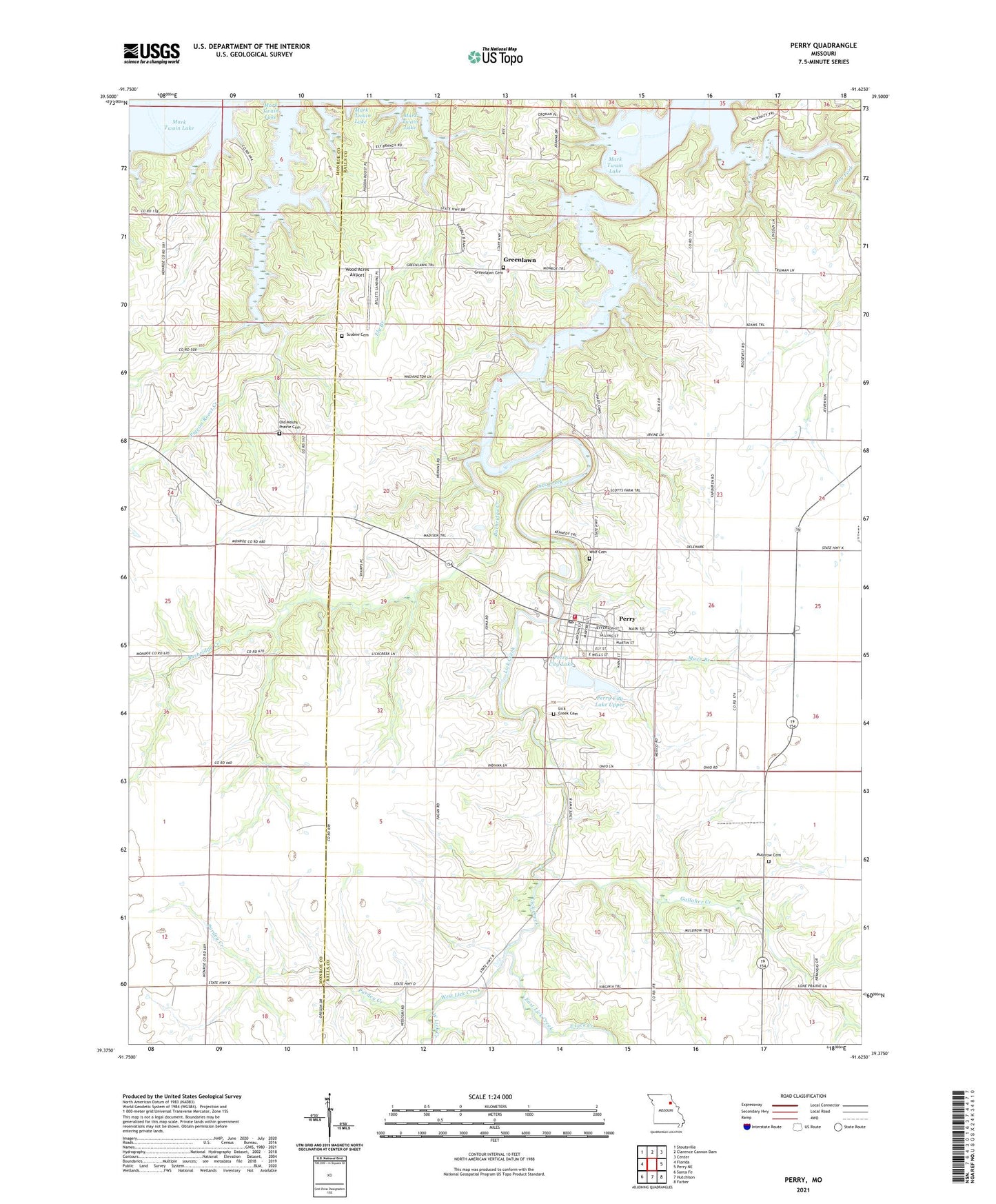
Perry Missouri US Topo Map
Couldn't load pickup availability
2021 topographic map quadrangle Perry in the state of Missouri. Scale: 1:24000. Based on the newly updated USGS 7.5' US Topo map series, this map is in the following counties: Ralls, Monroe. The map contains contour data, water features, and other items you are used to seeing on USGS maps, but also has updated roads and other features. This is the next generation of topographic maps. Printed on high-quality waterproof paper with UV fade-resistant inks.
Quads adjacent to this one:
West: Florida
Northwest: Stoutsville
North: Clarence Cannon Dam
Northeast: Center
East: Perry NE
Southeast: Farber
South: Hutchison
Southwest: Santa Fe
Contains the following named places: Ashbury Lake Dam, Burbridge Creek, City Lakes, City of Perry, East Lick Creek, Fagan School, Gallaher Creek, Gatson School, Greenlawn, Greenlawn Cemetery, Greenlawn Methodist Church, Heavenridge School, Irvine School, Jim Gough Airport, Lick Creek, Lick Creek Cemetery, Mace Branch, Mount Prairie Church, Muldrow Cemetery, Muldrow School, Number 571 Dam, Old Mount Prairie Cemetery, Perry, Perry City Dam - Lower, Perry City Dam Number 2, Perry City Lake, Perry City Lake Upper, Perry Elementary School, Perry Police Department, Perry Post Office, Perry Volunteer Fire Department, Pigeon Roost Creek, Purdey Creek, Robert E Allen Recreation Area, Scobee Cemetery, Tillett School, Township of Salt River, West Lick Creek, Wolf Cemetery, Wommack School, Wood Acres Airport, Wood Acres Dam, ZIP Code: 63462