MyTopo
Pinnacle Lake Missouri US Topo Map
Couldn't load pickup availability
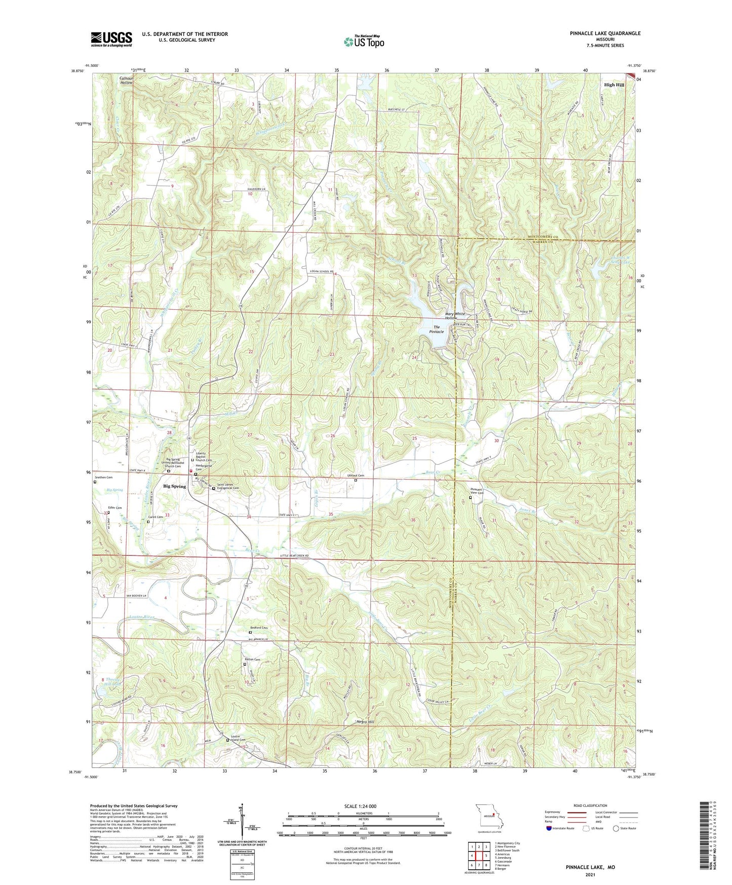
2021 topographic map quadrangle Pinnacle Lake in the state of Missouri. Scale: 1:24000. Based on the newly updated USGS 7.5' US Topo map series, this map is in the following counties: Montgomery, Warren. The map contains contour data, water features, and other items you are used to seeing on USGS maps, but also has updated roads and other features. This is the next generation of topographic maps. Printed on high-quality waterproof paper with UV fade-resistant inks.
Quads adjacent to this one:
West: Americus
Northwest: Montgomery City
North: New Florence
Northeast: Bellflower South
East: Jonesburg
Southeast: Berger
South: Hermann
Southwest: Gasconade
Contains the following named places: Abattis, Abattis Post Office, Bear Creek, Bedford Cemetery, Big Branch, Big Spring, Big Spring Census Designated Place, Big Spring Fire Protection District Station 1, Boone Lookout Tower, Borgers Lake Dam, Calhoun Hollow, Carell Cemetery, Charles W Seng Lake, Clark Branch, Daniel Boone Memorial State Forest, Dry Fork, Ebenezer School, Gryder Lake Dam, Haerer Lake Dam, High Hill Camp, Hugo Church, Hugo School, Johnson Lake Dam, Jones Branch, Liberty School, Little Bear Creek, Logan Branch, Logan School, Loutre Island Cemetery, Mary White Hollow, McKittrick School, Mill Creek, Millam Creek, Mononame 312 Dam, Negro Hill, Noble Lake Dam - North, Noble Lake South Dam, Painter Lake Dam, Patton Cemetery, Pinnacle Creek, Pinnacle Lake, Pinnacle Lake Dam, Pleasant View Cemetery, School Branch, Seng Lake Dam, Snethen Cemetery, Spring Branch, The Pinnacle, Thorney Hill Dam, Thorny Hill Lake, Turkey Branch, Uthlaut Cemetery, Walnut Grove School, Whippoorwill Creek