MyTopo
Bellflower South Missouri US Topo Map
Couldn't load pickup availability
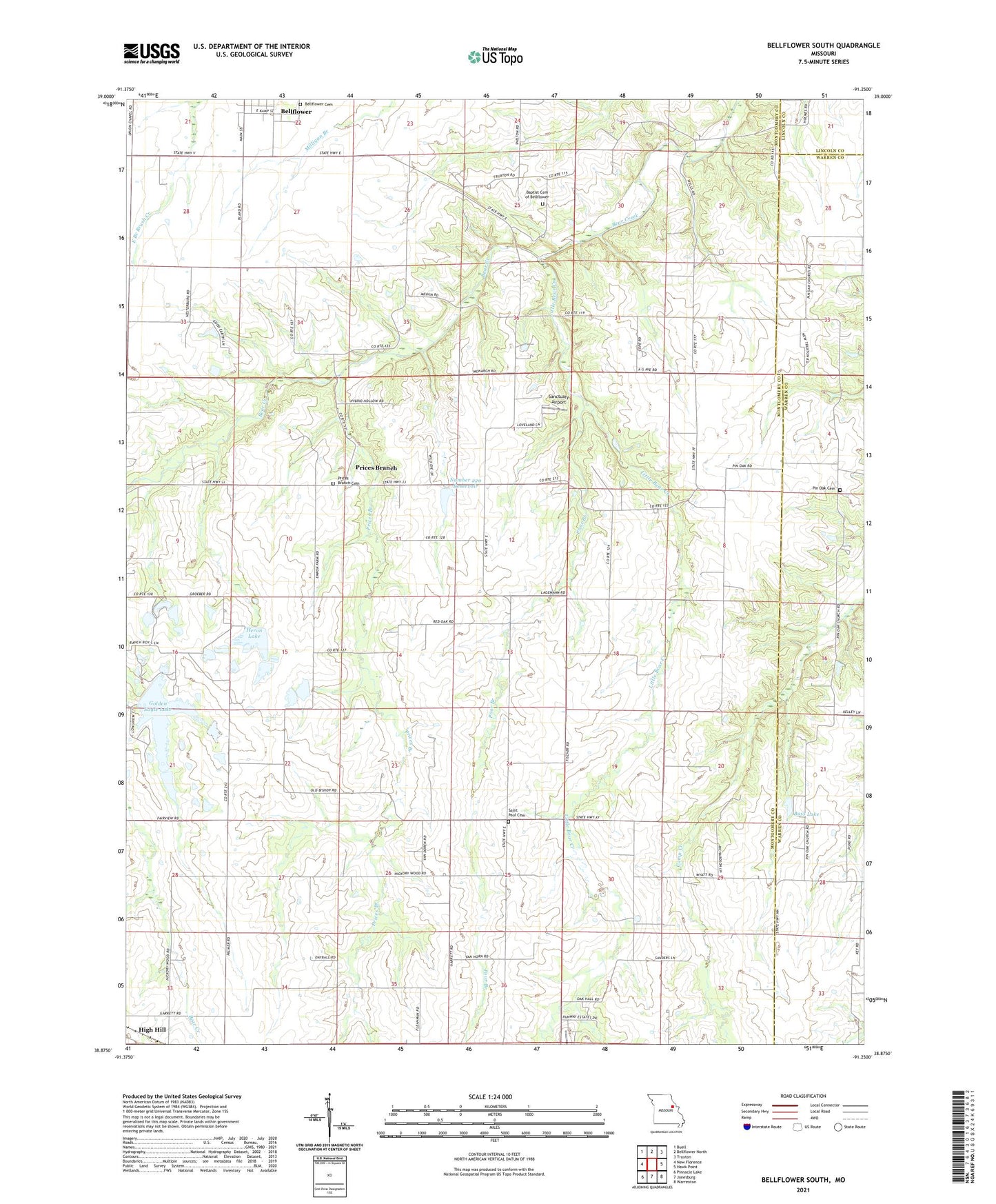
2021 topographic map quadrangle Bellflower South in the state of Missouri. Scale: 1:24000. Based on the newly updated USGS 7.5' US Topo map series, this map is in the following counties: Montgomery, Warren, Lincoln. The map contains contour data, water features, and other items you are used to seeing on USGS maps, but also has updated roads and other features. This is the next generation of topographic maps. Printed on high-quality waterproof paper with UV fade-resistant inks.
Quads adjacent to this one:
West: New Florence
Northwest: Buell
North: Bellflower North
Northeast: Truxton
East: Hawk Point
Southeast: Warrenton
South: Jonesburg
Southwest: Pinnacle Lake
This map covers the same area as the classic USGS quad with code o38091h3.
Contains the following named places: Baptist Cemetery of Bellflower, Bass Lake, Bass Lake Dam, Bellflower Cemetery, Bishop Lake Dam, Cool Valley Lake Dam, Domermuth Lake Dam, Godbold Irrigation Reservoir, Godbold Reservoir Dam, Golden Eagle Lake, Golden Eagle Lake Dam, Golden Eagle Lake Dam - Upper, Heron Lake, Heron Lake Dam Lower, Heron Lake Dam Upper, Hickory Wood School, Honey Locust School, KHQA-TV (Hannibal), Little Bear Creek, Number 220 Reservoir, Oak Hall School, Pin Oak Cemetery, Pin Oak Church, Pin Oak Community, Pinoak School, Poor Branch, Prairie Light School, Prices Branch, Prices Branch Cemetery, Prices Branch Christian Church, Prices Branch School, Providence Church, Saint Paul Cemetery, Sanctuary Airport, Shelton School, Township of Bear Creek, Wells School, Winter Lake Dam, Wyatt School, ZIP Codes: 63350, 63381