MyTopo
Poynor Missouri US Topo Map
Couldn't load pickup availability
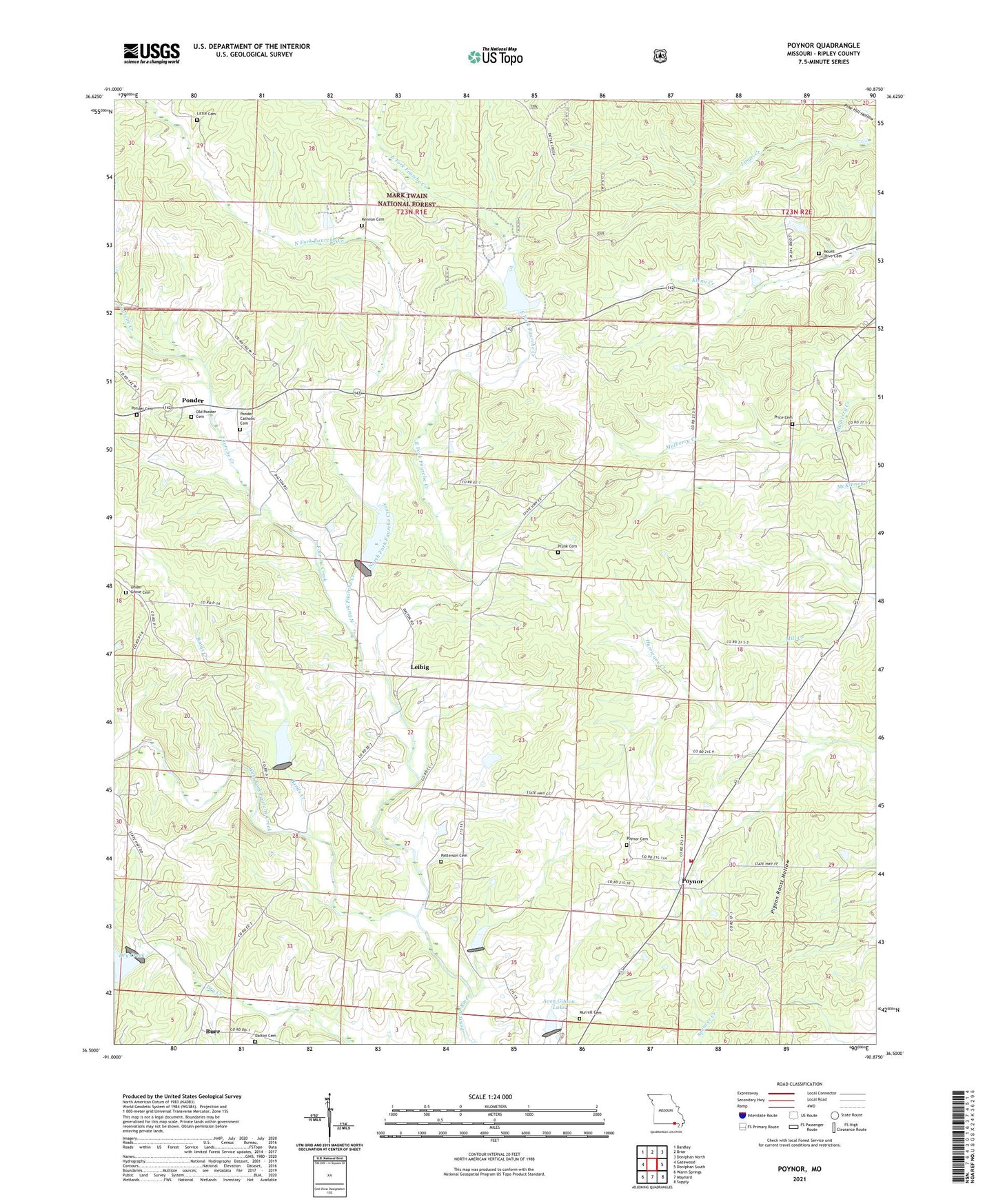
2021 topographic map quadrangle Poynor in the state of Missouri. Scale: 1:24000. Based on the newly updated USGS 7.5' US Topo map series, this map is in the following counties: Ripley. The map contains contour data, water features, and other items you are used to seeing on USGS maps, but also has updated roads and other features. This is the next generation of topographic maps. Printed on high-quality waterproof paper with UV fade-resistant inks.
Quads adjacent to this one:
West: Gatewood
Northwest: Bardley
North: Briar
Northeast: Doniphan North
East: Doniphan South
Southeast: Supply
South: Maynard
Southwest: Warm Springs
Contains the following named places: Avon Gibson Lake, Bellview West School, Bonds Creek, Burr, Dalton Cemetery, Doyle, Doyle Post Office, East Fork Fourche Creek, Flat Top School, Fourche Creek, Fourche Creek Watershed Number 12 Dam, Fourche Creek Watershed Number 13 Dam, Fourche Creek Watershed Number 7 Dam, Fourche Lake, Gatewood Volunteer Fire Department Station 2, Glen Holland Lake, Kennon Cemetery, Leibig, Little Cemetery, Mount Olive Church, Murrell Cemetery, New Home Church, North Fork Fourche Creek, Old Ponder Cemetery, Patterson Cemetery, Pigeon Roost Hollow, Plunk Cemetery, Plunk School, Ponder, Ponder Catholic Cemetery, Ponder School, Poynor, Poynor Census Designated Place, Poynor Church, Poynor School, Poynor Volunteer Fire Department, Price Cemetery, Price School, Ripley County Fairground, Rosson School, Sugar Tree School, Township of Poynor, Township of Union, Union Grove Cemetery, Union School, West Fork Fourche Creek