MyTopo
Quick City Missouri US Topo Map
Couldn't load pickup availability
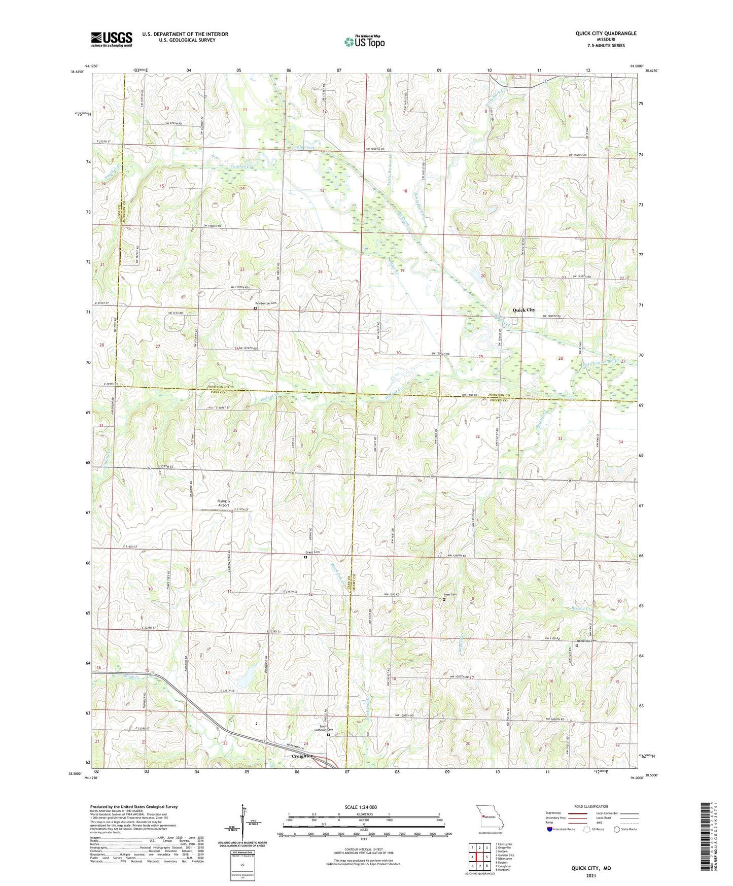
2021 topographic map quadrangle Quick City in the state of Missouri. Scale: 1:24000. Based on the newly updated USGS 7.5' US Topo map series, this map is in the following counties: Johnson, Cass, Henry. The map contains contour data, water features, and other items you are used to seeing on USGS maps, but also has updated roads and other features. This is the next generation of topographic maps. Printed on high-quality waterproof paper with UV fade-resistant inks.
Quads adjacent to this one:
West: Garden City
Northwest: East Lynne
North: Kingsville
Northeast: Holden
East: Blairstown
Southeast: Hartwell
South: Creighton
Southwest: Dayton
Contains the following named places: Bee Branch School, Bogard Creek, Bunker Hill School, Dover School, Flying G Airport, Forest School, Grant Cemetery, Hendricks Cemetery, Kaysinger Basin Planning Region, Little Walnut Creek, Mount Xenia School, Page Cemetery, Panther Creek, Pemberton Cemetery, Pleasant Ridge School, Pumpkin Green School, Quick City, Quick City School, Salmon Lake North, Salmon Lake North Dam, Salmon Lake South, Salmon Lake South Dam, Scaly Bark Creek, Sherwood Elementary School, Sherwood High School, Sherwood Middle School, Township of Bogard, Township of Rose Hill, Township of Sherman, Trinity Lutheran Cemetery, Wadesburg School, Walnut Creek, ZIP Code: 64739