MyTopo
Readsville Missouri US Topo Map
Couldn't load pickup availability
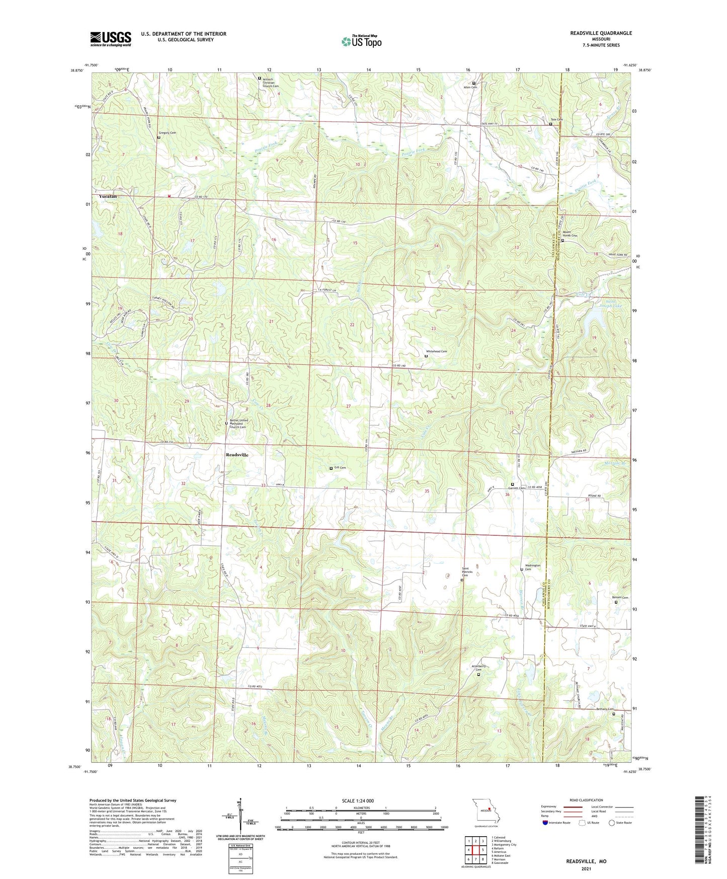
2021 topographic map quadrangle Readsville in the state of Missouri. Scale: 1:24000. Based on the newly updated USGS 7.5' US Topo map series, this map is in the following counties: Callaway, Montgomery. The map contains contour data, water features, and other items you are used to seeing on USGS maps, but also has updated roads and other features. This is the next generation of topographic maps. Printed on high-quality waterproof paper with UV fade-resistant inks.
Quads adjacent to this one:
West: Reform
Northwest: Calwood
North: Williamsburg
Northeast: Montgomery City
East: Americus
Southeast: Gasconade
South: Morrison
Southwest: Mokane East
Contains the following named places: Allen Cemetery, Antioch Christian Church Cemetery, Antioch Church, Atterberry Cemetery, Bensen Cemetery, Bethany Church, Bethel Church, Bull Branch, Bush School, Cedar Hill School, Egbert, Egbert Post Office, Embree Lake Dam, Garrett, Garrett Cemetery, Gill School, Gregory Cemetery, Gregory School, Gross Dam, Hancock Prairie, Mathews Lake Dam, Means Branch, Mount Horeb Church, North Callaway Fire Protection District Station 5, Readsville, Readsville School, Saint Joseph Lake, Saint Joseph Lake Dam, Saint Patricks Cemetery, Saint Patricks Church, Tate Cemetery, Township of Auxvasse, Viers School, Washington Cemetery, Whitehead Cemetery, Wright Lake Dam, ZIP Code: 65067