MyTopo
Rensselaer Missouri US Topo Map
Couldn't load pickup availability
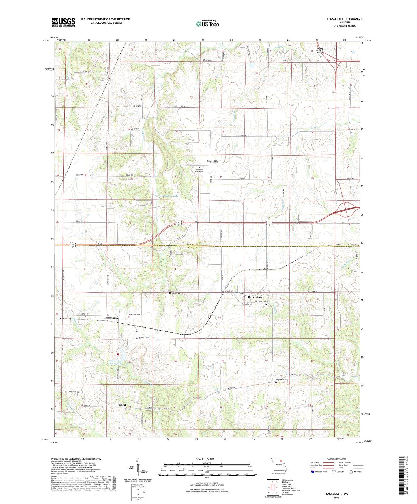
2021 topographic map quadrangle Rensselaer in the state of Missouri. Scale: 1:24000. Based on the newly updated USGS 7.5' US Topo map series, this map is in the following counties: Marion, Ralls. The map contains contour data, water features, and other items you are used to seeing on USGS maps, but also has updated roads and other features. This is the next generation of topographic maps. Printed on high-quality waterproof paper with UV fade-resistant inks.
Quads adjacent to this one:
West: Monroe City
Northwest: Philadelphia
North: Palmyra
Northeast: Quincy SW
East: Hannibal West
Southeast: New London
South: Center
Southwest: Clarence Cannon Dam
Contains the following named places: Barkley, Big Creek Cemetery, Central Stone County Dam, Central Stone County Lake, College Branch, Crabapple School, Evangelical Immanuel Lutheran Church, Finley Cemetery, Foreman Cemetery, Frankenbach Brothers Lake Dam, Gentry Dam, Huntington, Lake Hannibal, Lake Hannibal Dam, Lake Hannibal Estates Upper Dam, Monroe City Fire Department Substation, Rensselaer, Rensselaer Academy, Rowe School, Salt Lick Church, Sheil, Sylvan Lake, Township of South River, Village of Rensselaer, West Ely, West Ely Graveyard, West Ely School