MyTopo
Palmyra Missouri US Topo Map
Couldn't load pickup availability
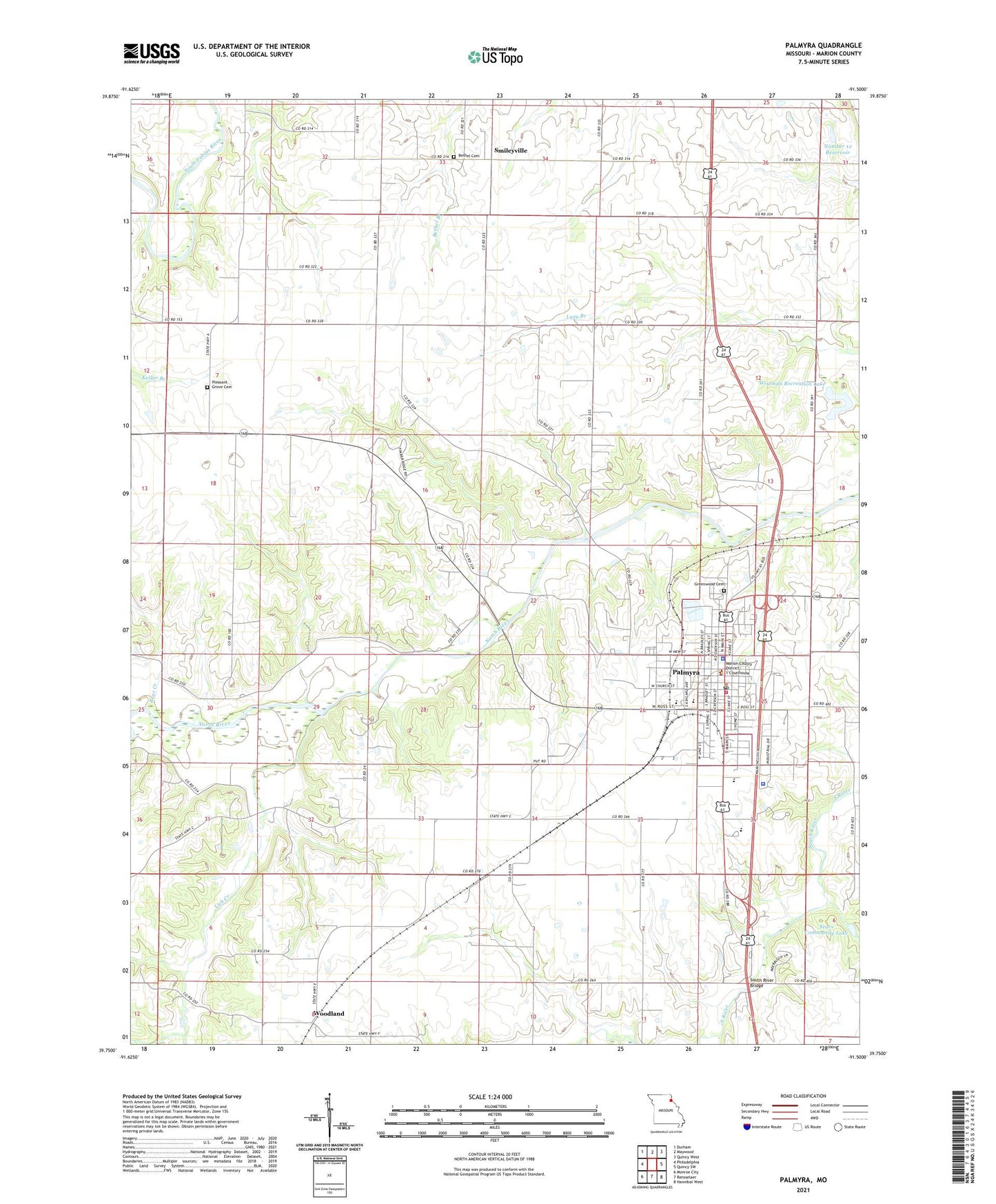
2021 topographic map quadrangle Palmyra in the state of Missouri. Scale: 1:24000. Based on the newly updated USGS 7.5' US Topo map series, this map is in the following counties: Marion. The map contains contour data, water features, and other items you are used to seeing on USGS maps, but also has updated roads and other features. This is the next generation of topographic maps. Printed on high-quality waterproof paper with UV fade-resistant inks.
Quads adjacent to this one:
West: Philadelphia
Northwest: Durham
North: Maywood
Northeast: Quincy West
East: Quincy SW
Southeast: Hannibal West
South: Rensselaer
Southwest: Monroe City
This map covers the same area as the classic USGS quad with code o39091g5.
Contains the following named places: Bethel Cemetery, Bethel Church, Bethel School, City of Palmyra, Dodge City, Four Corners, Gard Lake Dam, Greenwood Cemetery, Lick Creek, Marion County, Marion County Infirmary, Marion County Sheriff's Office, Massie Mill, Nelsons Branch, North River School, Number 12 Dam, Number 12 Reservoir, Old Covered Bridge, Palmyra, Palmyra Fire Department, Palmyra Junction, Palmyra Police Department, Palmyra Post Office, Peddicord School, Pleasant Grove Cemetery, Pleasant Grove Church, Pleasant Hill Church, Prairie View School, Salem School, Sears Community Lake, Slees Mills, Smileyville, South River Bridge, Stevens Dam, Stone Hill School, The Rhine, Todd School, Wiseman Recreation Lake, Woodland, Woodland School, ZIP Code: 63461