MyTopo
Rock Port Missouri US Topo Map
Couldn't load pickup availability
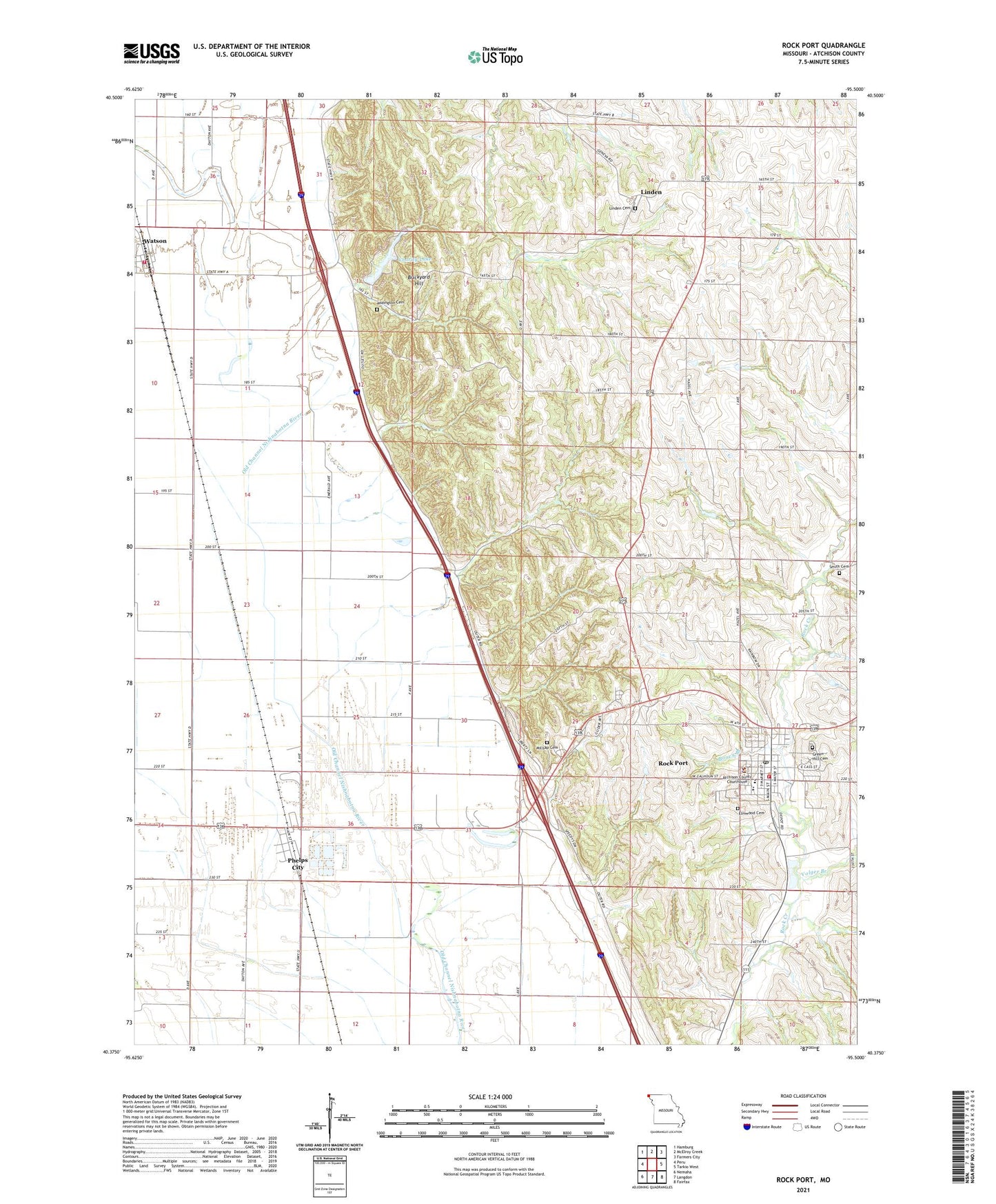
2021 topographic map quadrangle Rock Port in the state of Missouri. Scale: 1:24000. Based on the newly updated USGS 7.5' US Topo map series, this map is in the following counties: Atchison. The map contains contour data, water features, and other items you are used to seeing on USGS maps, but also has updated roads and other features. This is the next generation of topographic maps. Printed on high-quality waterproof paper with UV fade-resistant inks.
Quads adjacent to this one:
West: Peru
Northwest: Hamburg
North: McElroy Creek
Northeast: Farmers City
East: Tarkio West
Southeast: Fairfax
South: Langdon
Southwest: Nemaha
Contains the following named places: Addington Cemetery, Atchison County Sheriff's Office, Banner School, Boney Branch, Brickyard Hill, Brickyard Hill State Wildlife Area, Charity Lake, Charity Lake Dam, City of Rock Port, Elmwood Cemetery, Fairview School, Green Hill Cemetery, Hall Dam, Horseshoe Lake, Linden, Linden Cemetery, Lone Cedar School, McCoy Lake Dam, Memorial Park, Millsap Cemetery, New Hope School, Nishnabotna Lake, Oswald Dam, Oswald Lake, Phelps City, Phelps City Census Designated Place, Phelps City School, Pleasant Valley School, Red Star School, Rock Port, Rock Port Elementary School, Rock Port High School, Rock Port Municipal Airport, Rock Port Post Office, Shandy School, Smith Cemetery, Township of Clay, Township of Templeton, Village of Watson, Volger Branch, Watson, Watson Fire Department, West Atchison Rural Fire District Rock Port, ZIP Code: 64482