MyTopo
Rombauer Missouri US Topo Map
Couldn't load pickup availability
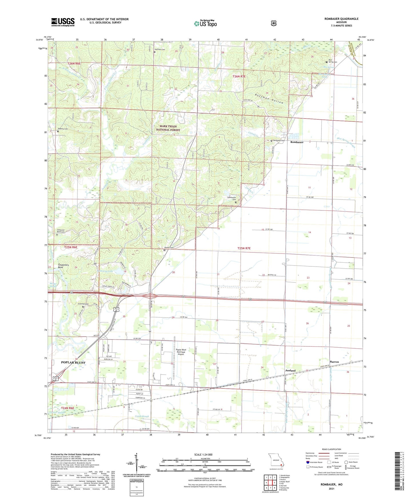
2021 topographic map quadrangle Rombauer in the state of Missouri. Scale: 1:24000. Based on the newly updated USGS 7.5' US Topo map series, this map is in the following counties: Butler, Stoddard. The map contains contour data, water features, and other items you are used to seeing on USGS maps, but also has updated roads and other features. This is the next generation of topographic maps. Printed on high-quality waterproof paper with UV fade-resistant inks.
Quads adjacent to this one:
West: Poplar Bluff
Northwest: Hendrickson
North: Wappapello
Northeast: Puxico
East: Fisk
Southeast: Broseley
South: Hanleyville
Southwest: Harviell
Contains the following named places: Barron, Baskey School, Blue Spring Cemetery, Blue Spring Pond, Blue Springs, Butler County Fire Protection District Lake Road Station, Caney Creek, Carpenter Bend Cemetery, Carpenters Bend, Cattail Creek, Dooley Cemetery, East Prong Indian Creek, Elbow Pond, Empire, English School, Fairview School, Franklin Creek, Green Hill Farm, Greenhill Cemetery, Hamtown, Hamtown Church, Hamtown School, Hodges Ferry, Hoffman Hollow, Holloway Lake, Holloway Lake Dam, Huffman Cemetery, Junland, Junland School, Kinzer, KJEZ-FM (Poplar Bluff), KLID-AM (Poplar Bluff), Lade School, Lake Road School, Lowell Junction, Mast School, Mud Creek, New Bethany Church, New Home Church, Panther Run Slough, Podesva Cemetery, Poplar Bluff Regional Business Airport, Poplar Bluff State Forest, Providence Church, Providence School, Rombauer, Rombauer Lookout Tower, Rose Pond, Sawyer, Snizer, Snyder Ditch, Snyder Ditch Church, Snyder School, Stephenson Cemetery, Township of Saint Francois, West Prong Indian Creek, ZIP Code: 63962