MyTopo
Rosebud Missouri US Topo Map
Couldn't load pickup availability
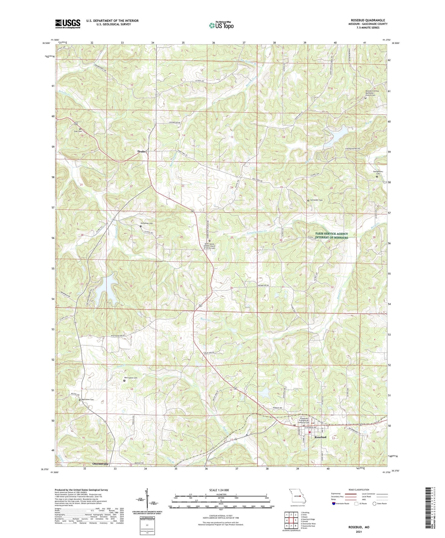
2021 topographic map quadrangle Rosebud in the state of Missouri. Scale: 1:24000. Based on the newly updated USGS 7.5' US Topo map series, this map is in the following counties: Gasconade. The map contains contour data, water features, and other items you are used to seeing on USGS maps, but also has updated roads and other features. This is the next generation of topographic maps. Printed on high-quality waterproof paper with UV fade-resistant inks.
Quads adjacent to this one:
West: Goerlisch Ridge
Northwest: Pershing
North: Swiss
Northeast: Dissen
East: Gerald
Southeast: Strain
South: Owensville East
Southwest: Owensville West
Contains the following named places: Ahmad Lake Dam, Becker Lake Dam, Beemont Church, Big Hollow Branch, Boston Lake Dam, Brandt Lake Dam, City of Rosebud, Daizy Valley Lake Dam, Daizy Vally Reservoir, Drake, Drake School, Georgetown Cemetery, Gerald - Rosebud Fire Protection District Station 3, Immanual Evangelical Lutheran Cemetery, Immanuel Cemetery, Jackson Lake Dam, Kiehl School, Lake Northwood, Lake Northwoods Dam, Lake Northwoods West Dam, Langejammer Creek, Langenberg Lake Dam, Laury Lake Dam, Limberg Lake Dam, Lone Grove School, Long Branch, Matthews Cemetery, New Salem Cemetery, New Salem Church, Palestine, Pleasant Hill School, Presbyterian Church, Rosebud, Rosebud Post Office, Saint James United Church of Christ, Saint James United Church of Christ Cemetery, Saint Johns Church, Saint Johns School, Schroeder Cemetery, Sunswept Lake Dam, Wiffenberg, Wiseman School, Zoar Cemetery, Zoar Church