MyTopo
Goerlisch Ridge Missouri US Topo Map
Couldn't load pickup availability
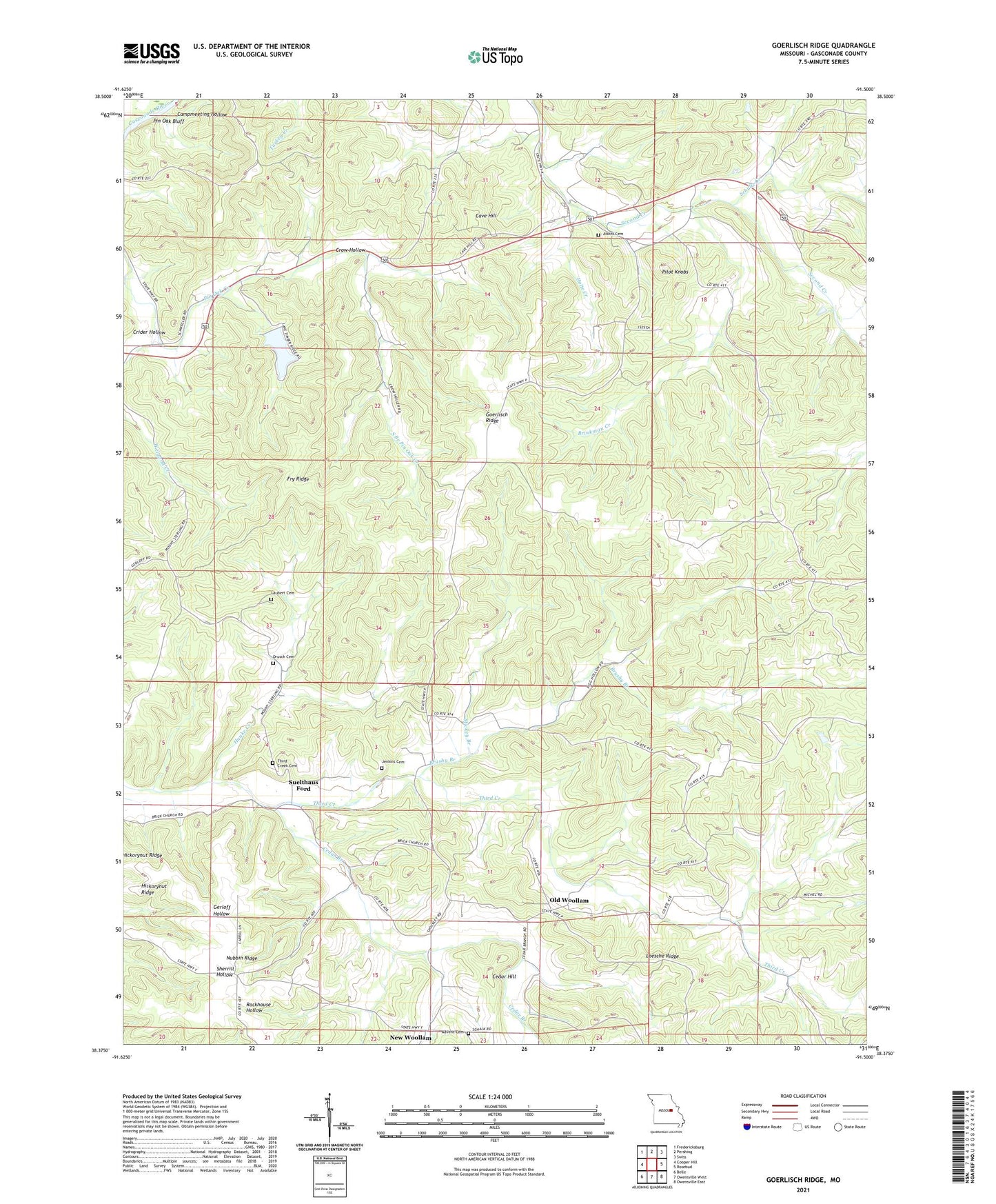
2021 topographic map quadrangle Goerlisch Ridge in the state of Missouri. Scale: 1:24000. Based on the newly updated USGS 7.5' US Topo map series, this map is in the following counties: Gasconade. The map contains contour data, water features, and other items you are used to seeing on USGS maps, but also has updated roads and other features. This is the next generation of topographic maps. Printed on high-quality waterproof paper with UV fade-resistant inks.
Quads adjacent to this one:
West: Cooper Hill
Northwest: Fredericksburg
North: Pershing
Northeast: Swiss
East: Rosebud
Southeast: Owensville East
South: Owensville West
Southwest: Belle
This map covers the same area as the classic USGS quad with code o38091d5.
Contains the following named places: Advent Cemetery, Atkins Cemetery, Bay School, Bethel Baptist Church, Brinkman Creek, Brushy Branch, Campmeeting Hollow, Cave Hill, Cedar Branch, Cedar Hill, Crow Hollow, Drusch Cemetery, Fry Ridge, Gasconade County, Goerlisch Ridge, Goerlisch School, Holte Creek, Hunke Creek, Jenkins Cemetery, Jenkins School, Kings Lookout, Lake Timber Ridge, Lake Timber Ridge Dam, Laubert Cemetery, Loesche Ridge, M E Church, Manda, Manda Post Office, Manda School, Mickey Branch, Mount Sterling School, Neese School, New Woollam, New Woollam Church, Nubbin Ridge, Number 538 Dam, Old Woollam, Pilot Knobs, Pin Oak Bluff, Saint Johns Church, Saint Paul School, Schulte Creek, South Branch Pin Oak Creek, Suelthaus Ford, Third Creek Cemetery, Township of Third Creek, Weigand Creek, Wiggins School, Witte Ford, Zoar Church