MyTopo
Owensville West Missouri US Topo Map
Couldn't load pickup availability
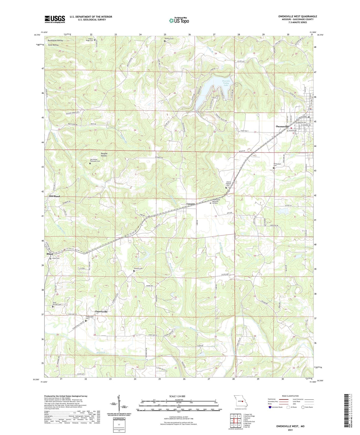
2021 topographic map quadrangle Owensville West in the state of Missouri. Scale: 1:24000. Based on the newly updated USGS 7.5' US Topo map series, this map is in the following counties: Gasconade. The map contains contour data, water features, and other items you are used to seeing on USGS maps, but also has updated roads and other features. This is the next generation of topographic maps. Printed on high-quality waterproof paper with UV fade-resistant inks.
Quads adjacent to this one:
West: Belle
Northwest: Cooper Hill
North: Goerlisch Ridge
Northeast: Rosebud
East: Owensville East
Southeast: Oak Hill
South: Redbird
Southwest: High Gate
This map covers the same area as the classic USGS quad with code o38091c5.
Contains the following named places: Barbarick School, Boettcher School, Branson Cemetery, Brush Creek, Canaan, Canaan Census Designated Place, Canaan Conservation Area, Cave Hollow, Cleavesville, Cleavesville School, Countryside Memorial Gardens, Douglas Hollow, Fairview Field, Howard Cemetery, Jasper Lake Dam, KZBR-FM (Owensville), Liberty Church, Lone Ridge School, McGowen Lake Dam, New Bethel Church, Nubbin Ridge Cemetery, Old Bland, Old Bland Creek, Old Bland School, Old United Methodist Cemetery, Owensville, Owensville City Police Department, Owensville Post Office, Owensville Volunteer Fire Department Main Station, Peaceful Valley Lake, Peaceful Valley Lake Dam, Richardson Cemetery, Rockhouse Hollow, Saint Michael Cemetery, Shockley Lake Dam, Sulphur Branch, Township of Clay, Trampe Lake Dam, Union Cemetery, United Methodist Church, Wallace School, Winter Field Airport