MyTopo
Madison Missouri US Topo Map
Couldn't load pickup availability
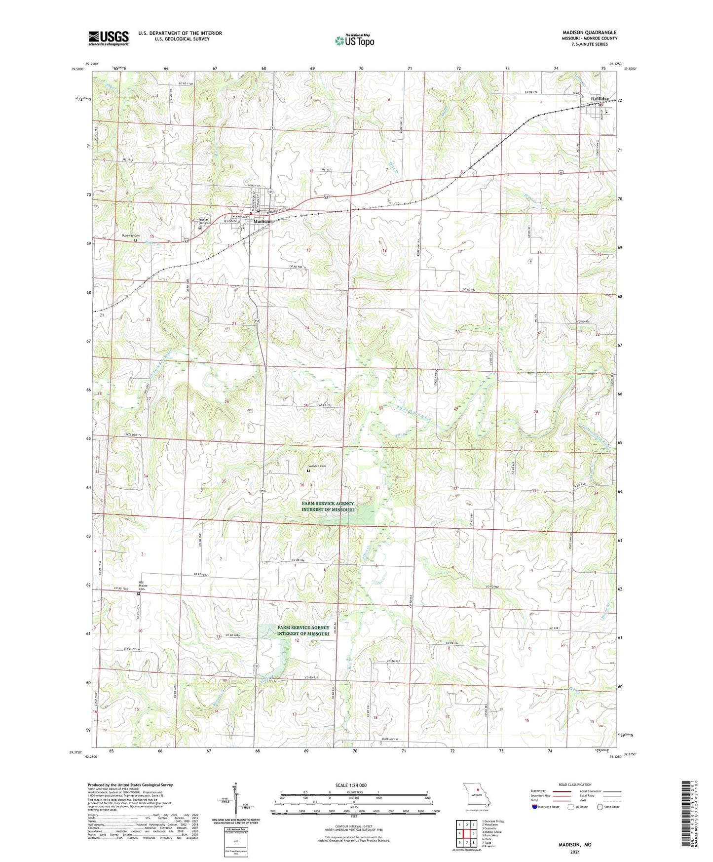
2021 topographic map quadrangle Madison in the state of Missouri. Scale: 1:24000. Based on the newly updated USGS 7.5' US Topo map series, this map is in the following counties: Monroe. The map contains contour data, water features, and other items you are used to seeing on USGS maps, but also has updated roads and other features. This is the next generation of topographic maps. Printed on high-quality waterproof paper with UV fade-resistant inks.
Quads adjacent to this one:
West: Middle Grove
Northwest: Duncans Bridge
North: Woodlawn
Northeast: Granville
East: Paris West
Southeast: Rowena
South: Tulip
Southwest: Clark
This map covers the same area as the classic USGS quad with code o39092d2.
Contains the following named places: Allen Creek, Baker Branch, Barnham School, Bee Branch, City of Madison, Dunaway Cemetery, Harley School, Holliday, Holliday Elementary School, Holliday Post Office, Horne Branch, Jacoby School, Madison, Madison and West Monroe Fire Protection District, Madison Elementary School, Madison High School, Madison Post Office, Mason School, New Hope School, O'Bannon Dam, Old Prairie Cemetery, Pedee Branch, Reese Fork, Sunset Hill Cemetery, Swindell Cemetery, Township of Marion, Township of Union, Village of Holliday, Wright School, ZIP Code: 65263