MyTopo
Saint Elizabeth Missouri US Topo Map
Couldn't load pickup availability
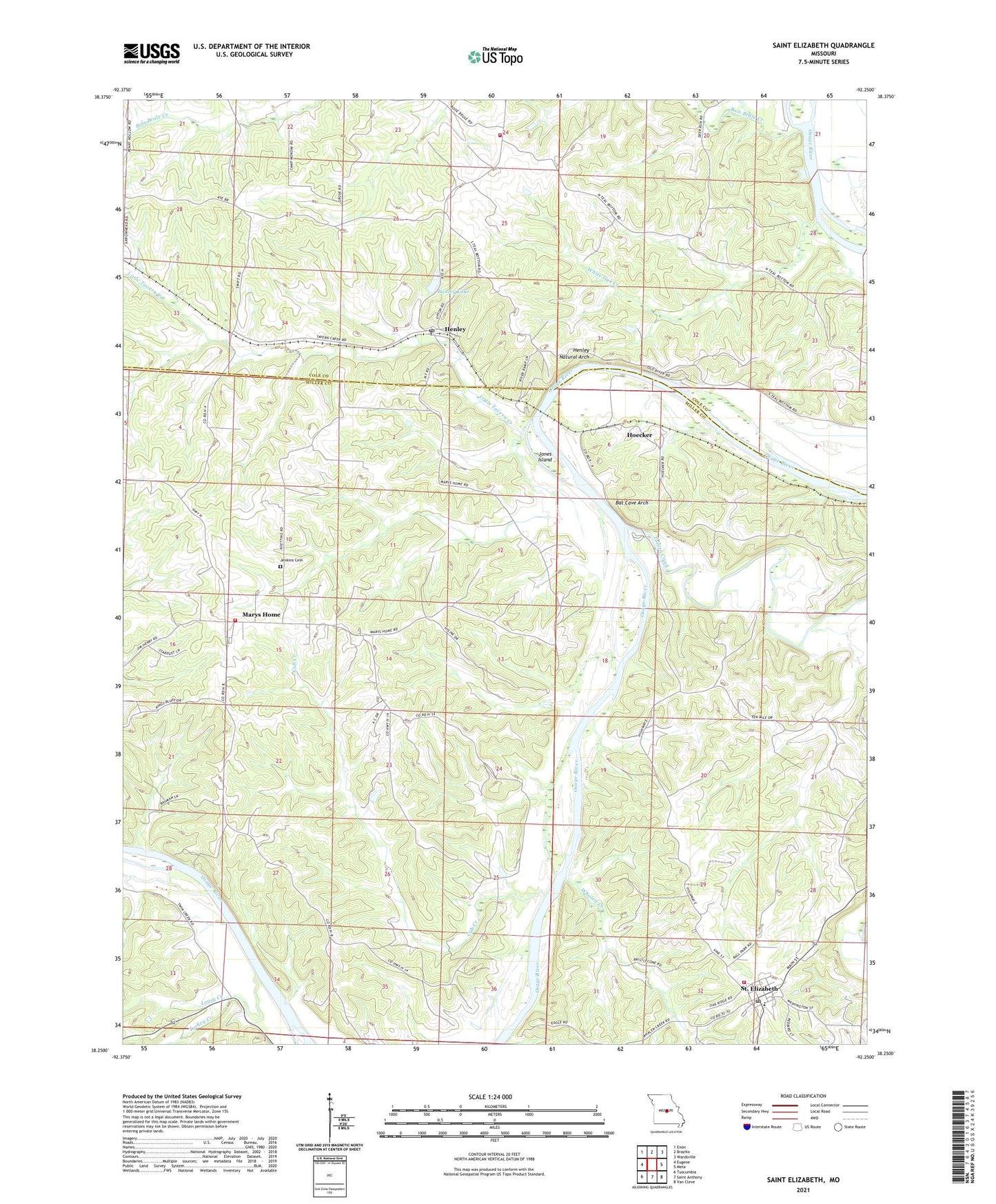
2021 topographic map quadrangle Saint Elizabeth in the state of Missouri. Scale: 1:24000. Based on the newly updated USGS 7.5' US Topo map series, this map is in the following counties: Miller, Cole. The map contains contour data, water features, and other items you are used to seeing on USGS maps, but also has updated roads and other features. This is the next generation of topographic maps. Printed on high-quality waterproof paper with UV fade-resistant inks.
Quads adjacent to this one:
West: Eugene
Northwest: Enon
North: Brazito
Northeast: Wardsville
East: Meta
Southeast: Van Cleve
South: Saint Anthony
Southwest: Tuscumbia
Contains the following named places: Bat Cave Arch, Bois Brule Creek, Cole County Fire Protection District Station 6, Cole County Fire Protection District Station 7, Cub Creek, Henley, Henley Lake, Henley Lake Dam, Henley Natural Arch, Henley Post Office, Hoecker, Jenkins Cemetery, Jones Island, Kempker School, Little Tavern Creek, Lousy Creek, Marys Home, Marys Home School, Old Elizabeth School, Osage-Tavern State Wildlife Area, Saint Elizabeth, Saint Elizabeth Post Office, Saint Elizabeth Volunteer Fire Department, Sanning School, Spring Valley Church, Spring Valley School, Tavern Creek, Teal School, Turkey Creek, Village of Saint Elizabeth, Whalen Creek, White Oak Creek, White Oak School, ZIP Code: 65040