MyTopo
Tuscumbia Missouri US Topo Map
Couldn't load pickup availability
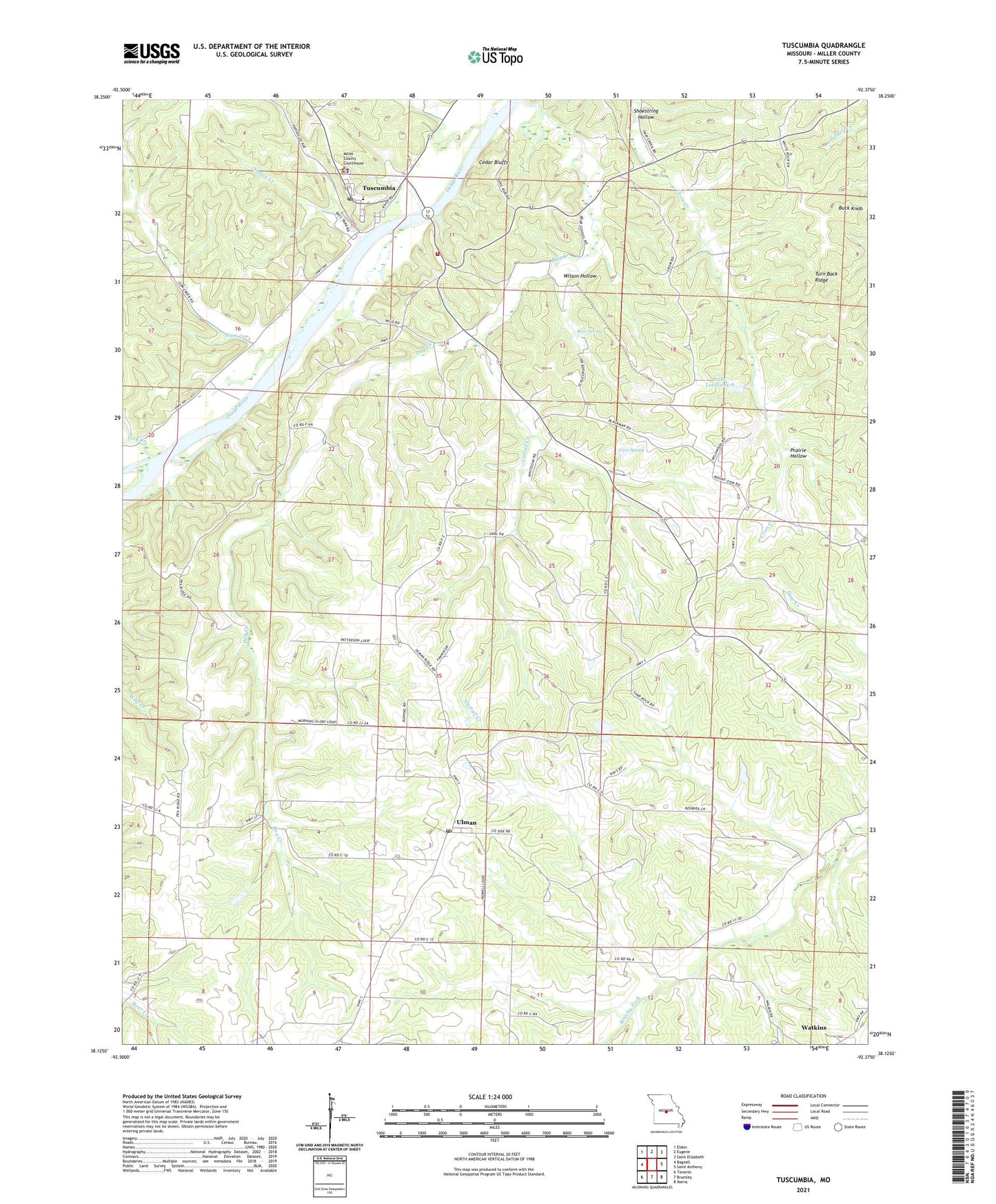
2021 topographic map quadrangle Tuscumbia in the state of Missouri. Scale: 1:24000. Based on the newly updated USGS 7.5' US Topo map series, this map is in the following counties: Miller. The map contains contour data, water features, and other items you are used to seeing on USGS maps, but also has updated roads and other features. This is the next generation of topographic maps. Printed on high-quality waterproof paper with UV fade-resistant inks.
Quads adjacent to this one:
West: Bagnell
Northwest: Eldon
North: Eugene
Northeast: Saint Elizabeth
East: Saint Anthony
Southeast: Iberia
South: Brumley
Southwest: Toronto
This map covers the same area as the classic USGS quad with code o38092b4.
Contains the following named places: Bear School, Bear Spring, Buck Knob, Cattail Creek, Cave Spring, Cedar Bluffs, Daggett Church, Dog Creek, Dog Creek School, Gum Creek, Helton Lake Dam, Hickory Point School, Hopewell Church, Howell Branch, Howell School, Keyes School, Lake Lottawatch, Lick Creek, Lurton School, Miller County, Miller County Home, Miller County Sheriff's Office, Mount Zion Church, Number Four School, Pisgah School, Pleasant Farm, Prairie Hollow, Procks Dam, Shoestring Hollow, Shutin Creek, Topping School, Town of Tuscumbia, Township of Equality, Truman Helton Dam, Truman Helton Lake, Turn Back Ridge, Tuscumbia, Tuscumbia Fire Protection District, Tuscumbia Post Office, Ulman, Ulman Post Office, Ulman State Tower Site, Wilson Hollow, ZIP Codes: 65082, 65083