MyTopo
Saint John Missouri US Topo Map
Couldn't load pickup availability
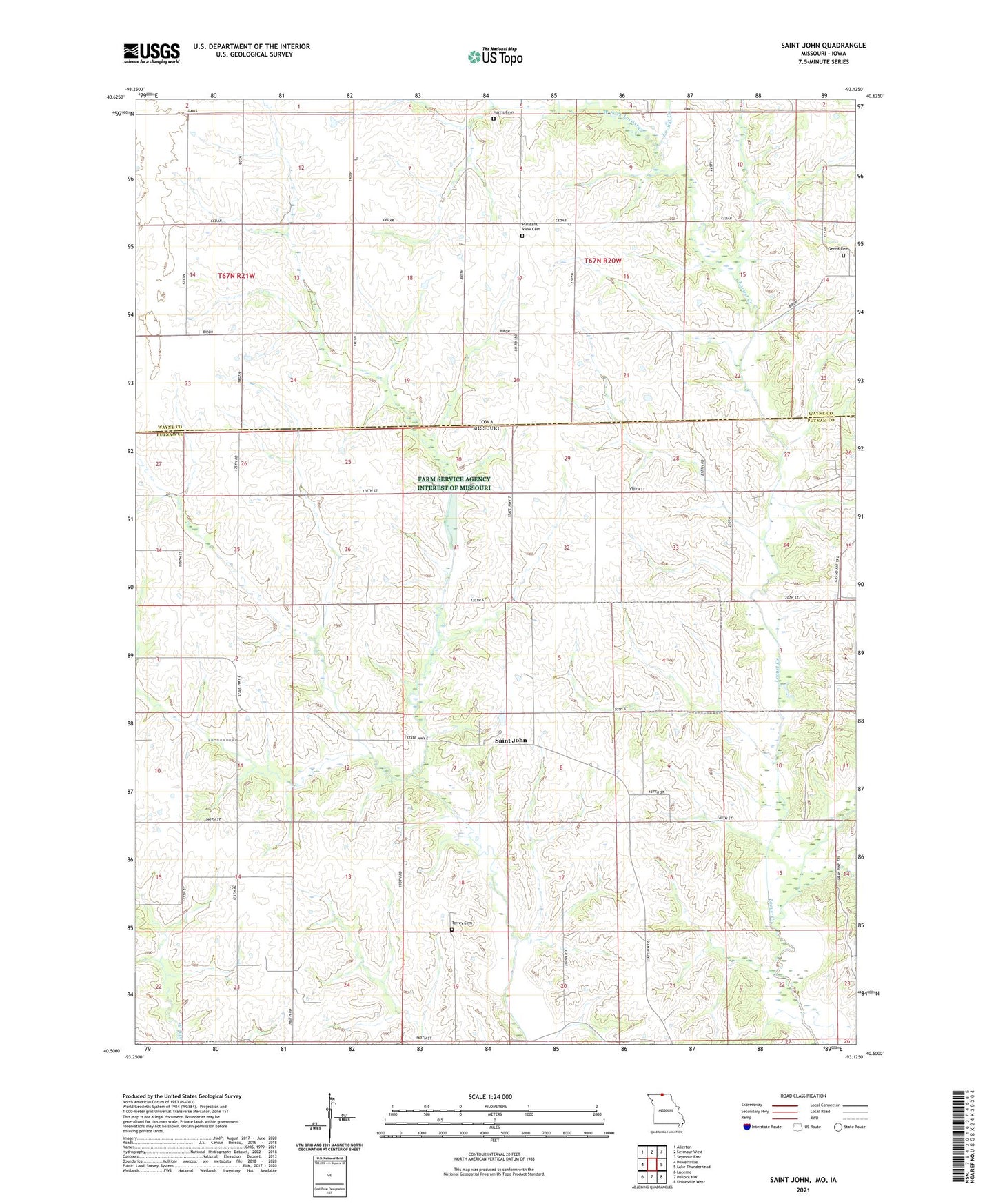
2021 topographic map quadrangle Saint John in the states of Missouri, Iowa. Scale: 1:24000. Based on the newly updated USGS 7.5' US Topo map series, this map is in the following counties: Putnam, Wayne. The map contains contour data, water features, and other items you are used to seeing on USGS maps, but also has updated roads and other features. This is the next generation of topographic maps. Printed on high-quality waterproof paper with UV fade-resistant inks.
Quads adjacent to this one:
West: Powersville
Northwest: Allerton
North: Seymour West
Northeast: Seymour East
East: Lake Thunderhead
Southeast: Unionville West
South: Pollock NW
Southwest: Lucerne
This map covers the same area as the classic USGS quad with code o40093e2.
Contains the following named places: Beary School, Genoa Cemetery, Harris Cemetery, Hill Crest School, Hope Chapel, Livingston Post Office, Pleasant View Cemetery, Saint John, Saint John School, Scott School, Seaton Lake Dam, Sells School, Torrey Cemetery, Township of Monroe, Township of Sherman, West Fork Locust Creek