MyTopo
Seymour East Iowa US Topo Map
Couldn't load pickup availability
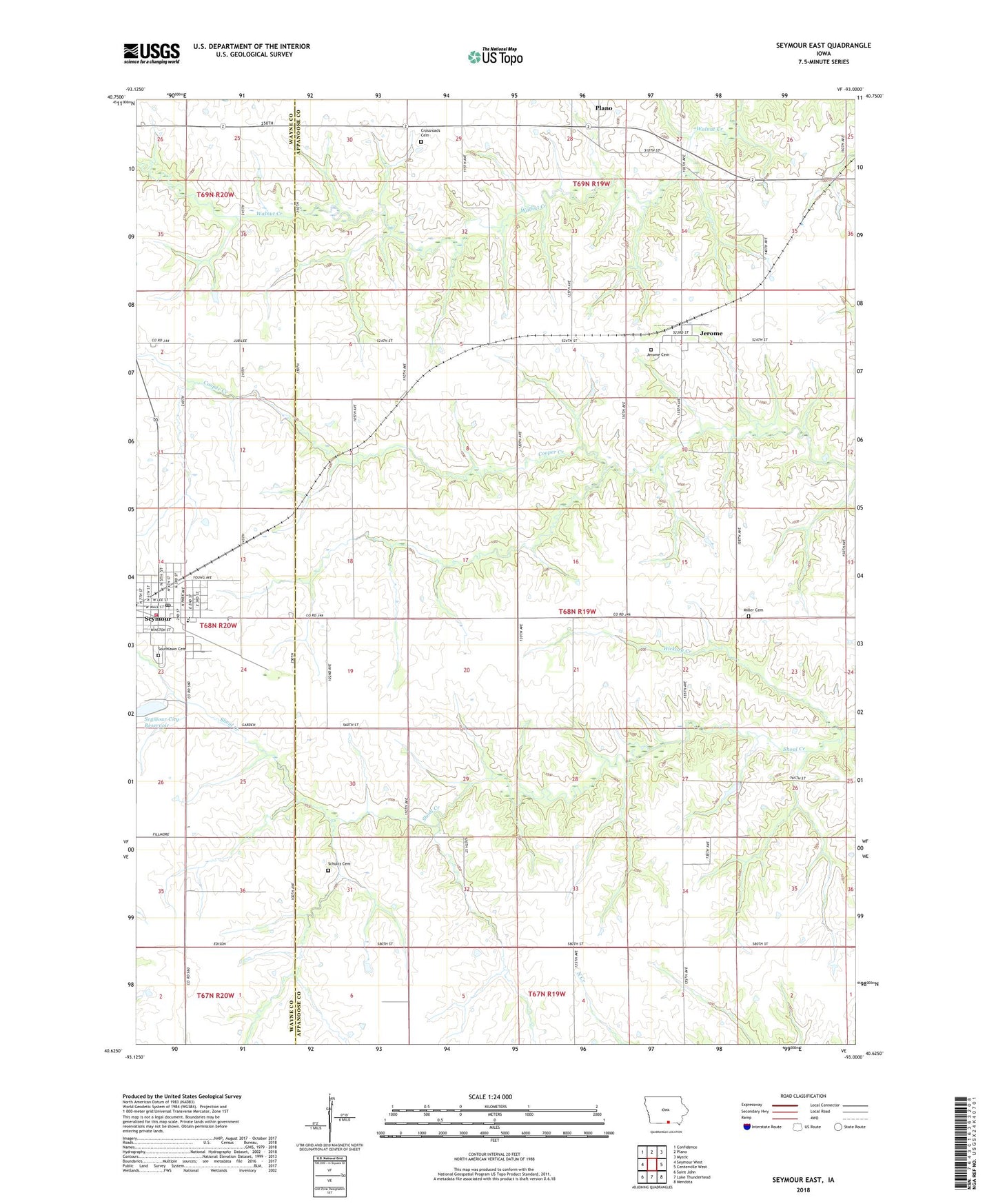
2022 topographic map quadrangle Seymour East in the state of Iowa. Scale: 1:24000. Based on the newly updated USGS 7.5' US Topo map series, this map is in the following counties: Appanoose, Wayne. The map contains contour data, water features, and other items you are used to seeing on USGS maps, but also has updated roads and other features. This is the next generation of topographic maps. Printed on high-quality waterproof paper with UV fade-resistant inks.
Quads adjacent to this one:
West: Seymour West
Northwest: Confidence
North: Plano
Northeast: Mystic
East: Centerville West
Southeast: Mendota
South: Lake Thunderhead
Southwest: Saint John
This map covers the same area as the classic USGS quad with code o40093f1.
Contains the following named places: Assembly of God Church, City of Seymour, Crossroads Cemetery, First Baptist Church, First Christian Church, Fowler Elevator Incorporated Elevator, Harkes Post Office, Hickory Creek, Jerome, Jerome Cemetery, Jerome Post Office, Johnstown Post Office, Little Flock Chapel, Little Flock Chapel Roadside Rest Area, Marsdenville, Marsdenville Post Office, Miller Cemetery, Seymour, Seymour Care Center, Seymour City Reservoir, Seymour Elementary School, Seymour Fire Station, Seymour High School, Seymour Lake Park, Seymour Medical Clinic, Seymour Post Office, Seymour Public Library, Seymour Volunteer Fire Department, Shoultz Cemetery, Southlawn Cemetery, Township of Franklin, Township of Lincoln, United Methodist Church, Walsh Post Office, ZIP Code: 52590