MyTopo
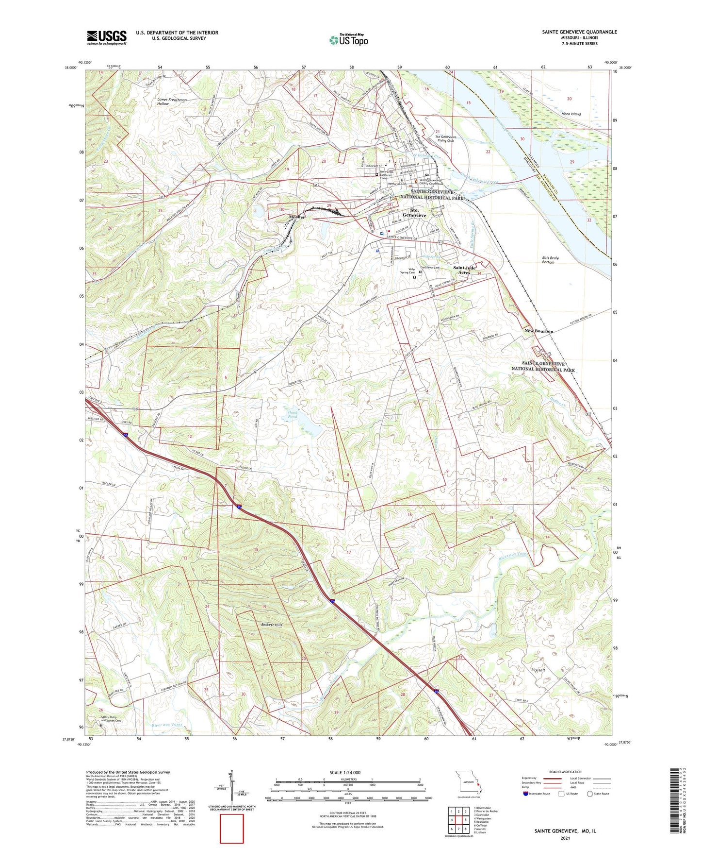
Sainte Genevieve Missouri US Topo Map
Couldn't load pickup availability
2021 topographic map quadrangle Sainte Genevieve in the states of Missouri, Illinois. Scale: 1:24000. Based on the newly updated USGS 7.5' US Topo map series, this map is in the following counties: Ste. Genevieve, Randolph. The map contains contour data, water features, and other items you are used to seeing on USGS maps, but also has updated roads and other features. This is the next generation of topographic maps. Printed on high-quality waterproof paper with UV fade-resistant inks.
Quads adjacent to this one:
West: Weingarten
Northwest: Bloomsdale
North: Prairie du Rocher
Northeast: Evansville
East: Kaskaskia
Southeast: Lithium
South: Minnith
Southwest: Coffman
This map covers the same area as the classic USGS quad with code o37090h1.
Contains the following named places: Beckett Hills, Big Field, Bois Brule Bottom, Bourbon School, City of Ste. Genevieve, Compressor Station, Evening Shade School, Fairview School, Govro Dam, Govro Lake, Holy Cross Lutheran Cemetery, Hook Pond, Inkley Marble Quarry, Kehl School, Kinkle School, KSTZ-FM (St Genevieve), Kunkle School, Lick Hill, Lick Hill School, Louis Bolduc House, Marlo, Marlo Mine and Plant, Memorial Cemetery, Mississippi Mine, Mississippi Slough, Morning Sun School, Moro School, Mosher, New Bourbon, North Gabouri Creek, Pere Marquette Park, Pointe Basse Plaza, Quarreton School, Quarry Town, Saint Genevieve County Memorial Hospital, Saint Jude Acres, Sainte Genevieve, Sainte Genevieve County Sheriff's Office, Sainte Genevieve Fire Department, Sainte Genevieve Historic District, Sainte Genevieve National Historical Park, Sainte Genevieve Police Department, Sainte Genevieve Post Office, Saints Phillip and James Church, South Gabouri Creek, Ste Genevieve Flying Club, Township of Sainte Genevieve, Valle Spring, Valle Spring Branch, Valle Spring Cemetery, Valle Spring Church, ZIP Code: 62261