MyTopo
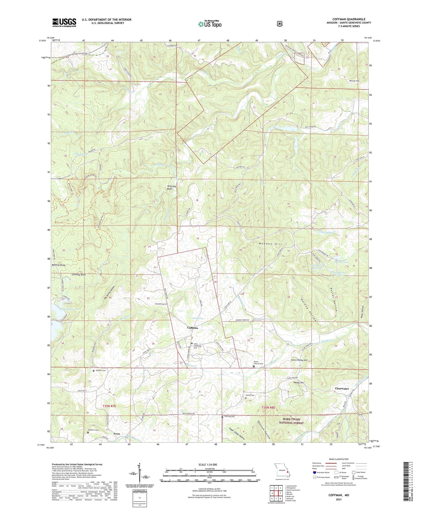
Coffman Missouri US Topo Map
Couldn't load pickup availability
Also explore the Coffman Forest Service Topo of this same quad for updated USFS data
2021 topographic map quadrangle Coffman in the state of Missouri. Scale: 1:24000. Based on the newly updated USGS 7.5' US Topo map series, this map is in the following counties: Ste. Genevieve. The map contains contour data, water features, and other items you are used to seeing on USGS maps, but also has updated roads and other features. This is the next generation of topographic maps. Printed on high-quality waterproof paper with UV fade-resistant inks.
Quads adjacent to this one:
West: Sprott
Northwest: Lawrenceton
North: Weingarten
Northeast: Sainte Genevieve
East: Minnith
Southeast: Parker Lake
South: Womack
Southwest: Knob Lick
This map covers the same area as the classic USGS quad with code o37090g2.
Contains the following named places: Avon, Avon Lead Mines, Avon School, Basler Hollow, Beehive Knob, Big Spring Hollow, Bloom Creek, Bluff Creek, Brands Lake, Brands Lake Dam Section 22 SE, Brands Lower Lake Section 22 Dam, Brands Upper Lake Section 22 Dam, Burns School, Butterfly Lake, Butterfly Lake Dam, Cheesebrough Hill, Chimney Rock, Clearwater, Coffman, Coffman Lookout Tower, Coffman School, Coffman Tower Site State Public Hunting Area, Coldwater Creek, Gordon School, Haney Cemetery, Haney Hill, Hawn State Park, Herzog Hollow, Jackson Cemetery, Jonca Creek, La Hae Spring, Lake Kal-Tatri, Lake Kal-Tatri Dam, Laura Valley Hill, Madden Hill, Mayberry Cemetery, Mertell Hill, Number 210 Reservoir, Number 211 Reservoir, Number 31 Dam, Number 31 Lake, Number 32 Dam, Number 32 Lake, Oakgrove School, Oakland School, Pickle Creek, Pine Log Cemetery, Pine Log Church, Rainbow Lake, Rainbow Lake Dam, Rock Spring, Rock Spring School, Roper Hollow, Rough Creek, Smith School, Stone Church Cemetery, Stone Methodist Church, Township of Saline, Wild Hog Bluff, Womack Branch