MyTopo
Lithium Missouri US Topo Map
Couldn't load pickup availability
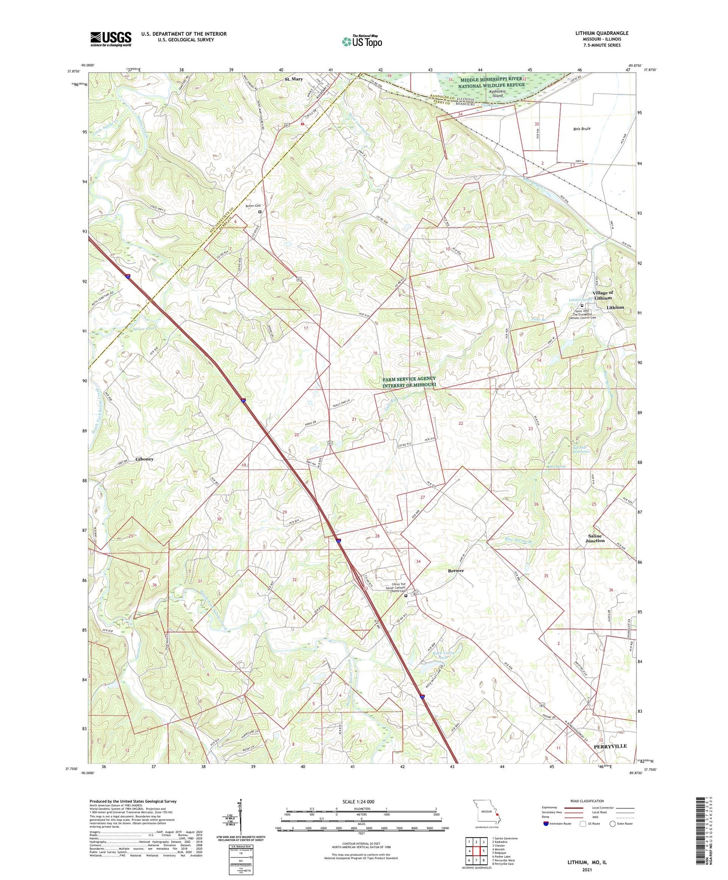
2021 topographic map quadrangle Lithium in the state of Missouri. Scale: 1:24000. Based on the newly updated USGS 7.5' US Topo map series, this map is in the following counties: Perry, Ste. Genevieve, Randolph. The map contains contour data, water features, and other items you are used to seeing on USGS maps, but also has updated roads and other features. This is the next generation of topographic maps. Printed on high-quality waterproof paper with UV fade-resistant inks.
Quads adjacent to this one:
West: Minnith
Northwest: Sainte Genevieve
North: Kaskaskia
Northeast: Chester
East: Belgique
Southeast: Perryville East
South: Perryville West
Southwest: Parker Lake
This map covers the same area as the classic USGS quad with code o37089g8.
Contains the following named places: Ball Mill Resurgence, Blue Spring, Blue Spring Branch, Bois Brule School, Brewer, Brewer Census Designated Place, Brown Cemetery, Cedar Fork, Cedar Valley Lake, Cedar Valley Lake Dam, Circle K Dam, Circle K Ranch Lake, Cissell School, City of Saint Mary, Colfelt Branch, Ellis Lake Dam, Falls Branch, Giboney, Goose Creek, Guethle School, Guittar Hollow, Knob School, Lach Difani Dam, Lakenan Lake Dam, Lithium, Lithium Census Designated Place, Lithium Spring, Little Saline Creek, Mattingly School, Moranville School, Perryville Junction, Rock Valley Lake, Rock Valley Lake Dam, Saint Laurent Creek, Saint Mary Volunteer Fire Department, Saline Junction, Thompson School, Township of Saline, Tucker School, Village of Lithium, ZIP Code: 63673