MyTopo
Santa Fe Missouri US Topo Map
Couldn't load pickup availability
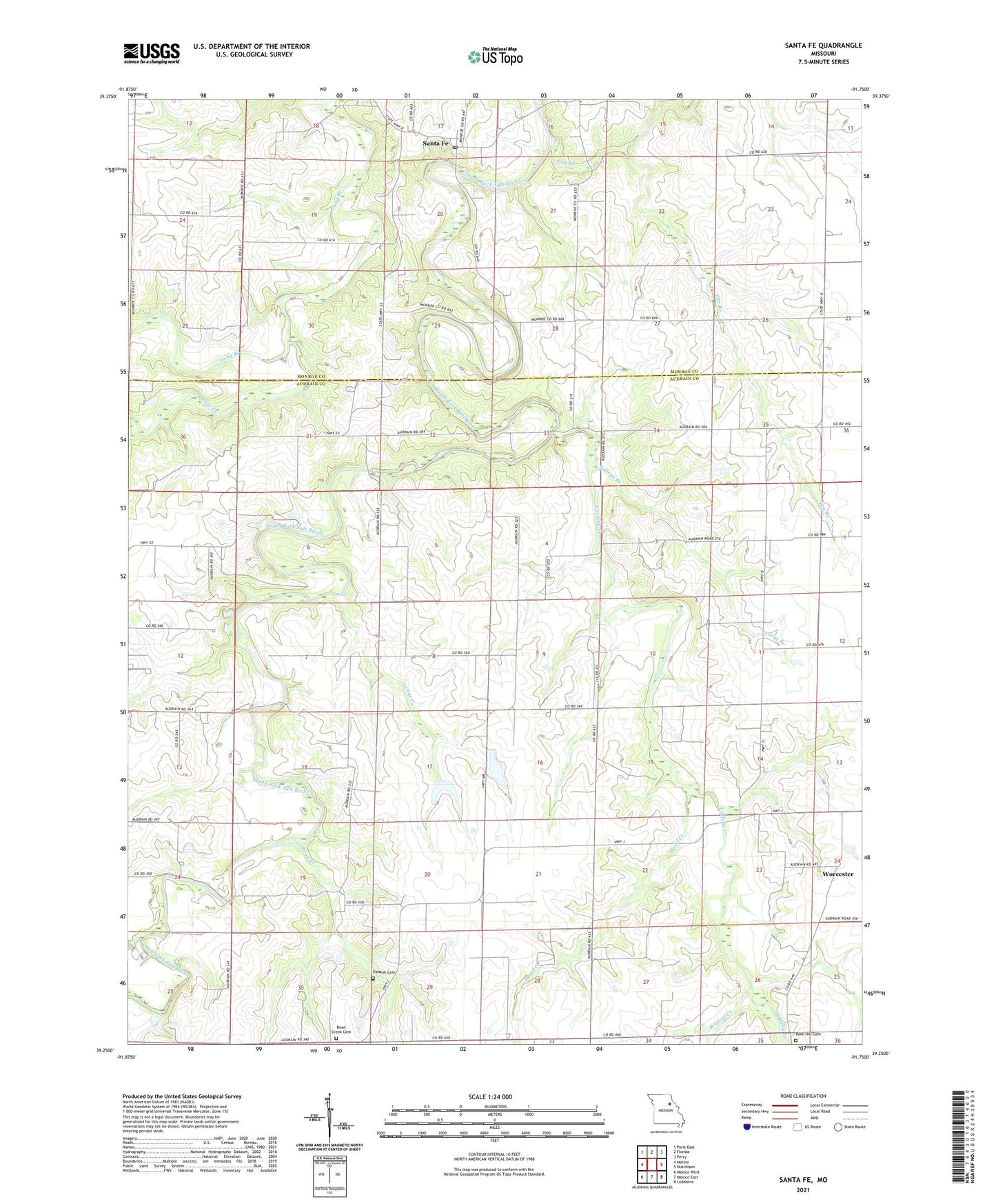
2021 topographic map quadrangle Santa Fe in the state of Missouri. Scale: 1:24000. Based on the newly updated USGS 7.5' US Topo map series, this map is in the following counties: Audrain, Monroe. The map contains contour data, water features, and other items you are used to seeing on USGS maps, but also has updated roads and other features. This is the next generation of topographic maps. Printed on high-quality waterproof paper with UV fade-resistant inks.
Quads adjacent to this one:
West: Molino
Northwest: Paris East
North: Florida
Northeast: Perry
East: Hutchison
Southeast: Laddonia
South: Mexico East
Southwest: Mexico West
Contains the following named places: Azdell Lake Dam, Beagles School, Bean Creek, Bean Creek Cemetery, Bean Creek School, Bethel Church, Botts School, Dye School, Elm Branch, Eubank Cemetery, Fisher School, Hazel Creek, Hazel School, Littleby Church, Littleby Creek, Long Branch, May Lake Dam, Millard Lake Dam, Ringo School, Rock Hill Cemetery, Santa Fe, Santa Fe Post Office, Talleys Branch, Tattys Creek, Wafer Ash School, Wildcat Creek, Worcester, Youngs Creek