MyTopo
Shell Knob Missouri US Topo Map
Couldn't load pickup availability
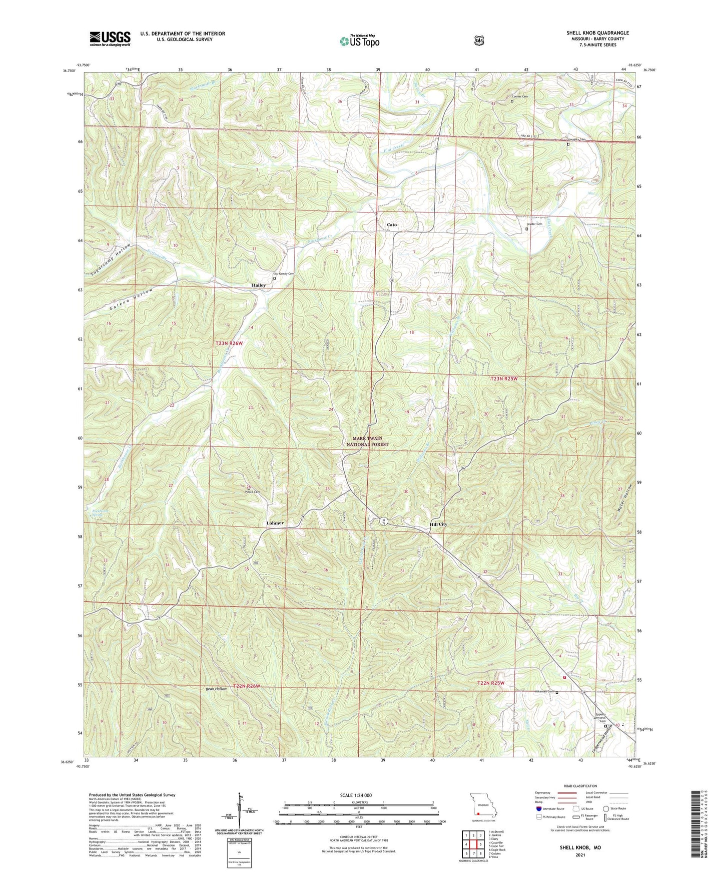
2021 topographic map quadrangle Shell Knob in the state of Missouri. Scale: 1:24000. Based on the newly updated USGS 7.5' US Topo map series, this map is in the following counties: Barry. The map contains contour data, water features, and other items you are used to seeing on USGS maps, but also has updated roads and other features. This is the next generation of topographic maps. Printed on high-quality waterproof paper with UV fade-resistant inks.
Quads adjacent to this one:
West: Cassville
Northwest: McDowell
North: Jenkins
Northeast: Elsey
East: Cape Fair
Southeast: Viola
South: Golden
Southwest: Eagle Rock
Contains the following named places: Bailey Branch, Blacksmith Branch, Cato, Cedar Mound School, Central Crossing Fire Protection District Station 1, Coones Cemetery, Doughty Cemetery, Epperly Memorial Cemetery, Fairview School, Fortune Branch, Gaddis School, Galena Hollow, Hailey, Hailey School, Hill City, Lahmer Fire Lookout Tower, Lohmer, Mount View Church, Mountain Home School, Pierce Cemetery, Rockhouse Creek, Rockhouse Hollow, Rockhouse Spring, Shell Knob, Shell Knob Elementary School, Shell Knob School, Snyder Cemetery, Sugarcamp Hollow, Township of Mineral, Township of Shell Knob, Williams Branch, Woods Trail