MyTopo
McDowell Missouri US Topo Map
Couldn't load pickup availability
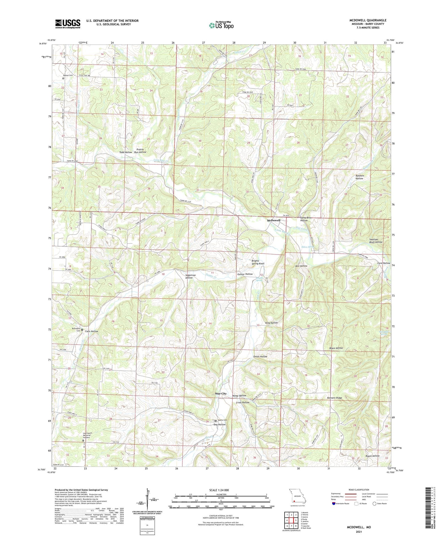
2021 topographic map quadrangle McDowell in the state of Missouri. Scale: 1:24000. Based on the newly updated USGS 7.5' US Topo map series, this map is in the following counties: Barry. The map contains contour data, water features, and other items you are used to seeing on USGS maps, but also has updated roads and other features. This is the next generation of topographic maps. Printed on high-quality waterproof paper with UV fade-resistant inks.
Quads adjacent to this one:
West: Purdy
Northwest: Monett
North: Verona
Northeast: Aurora
East: Jenkins
Southeast: Shell Knob
South: Cassville
Southwest: Exeter
This map covers the same area as the classic USGS quad with code o36093g7.
Contains the following named places: Baldwin Hollow, Bennett Ridge, Bethel Church, Bethel School, Brights Spring, Brights Spring Knoll, Bullington Cemetery, Calls Hollow, Calton Creek, Camp Bliss Hollow, Cedar Bluff School, Cross Hollow, Dog Hollow, Easyville Church, Gunter Creek, Gunter Hollow, Hilton Spring, Kemp Hollow, King Hollow, Little Flat Creek, Log Church, Lone Hill School, Marbut School, McDowell, McDowell Post Office, McDowell School, Mill Hollow, Onion Hollow, Prairie Run Hollow, Sparks Cemetery, Sparks School, Stansberry Creek, Star City, Star School, Sugartree Hollow, Swallow Bluff Hollow, Todd Hollow, Township of McDonald, Township of McDowell, Victory Church, Victory School, Wall Bluff Spring