MyTopo
Jenkins Missouri US Topo Map
Couldn't load pickup availability
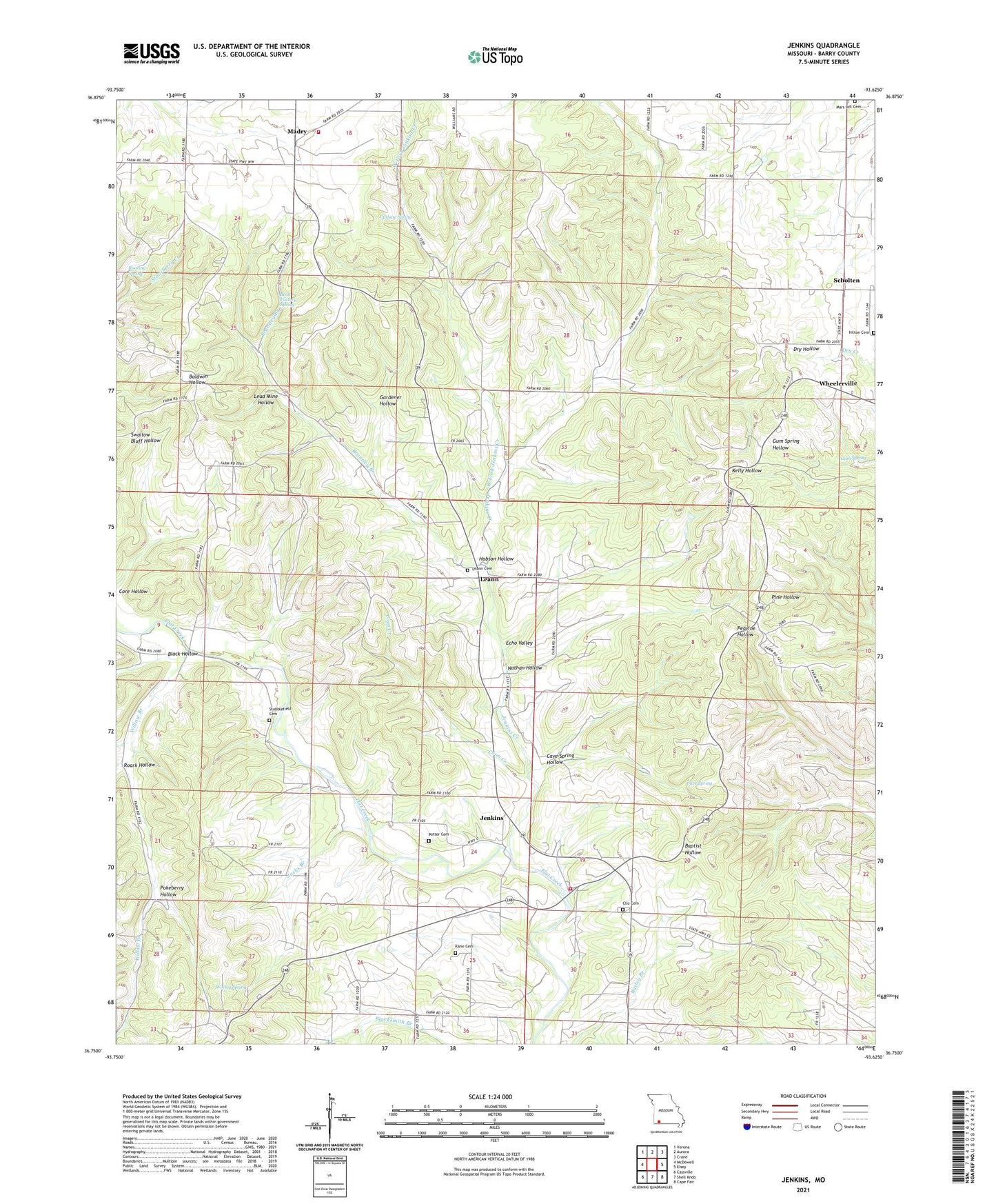
2021 topographic map quadrangle Jenkins in the state of Missouri. Scale: 1:24000. Based on the newly updated USGS 7.5' US Topo map series, this map is in the following counties: Barry. The map contains contour data, water features, and other items you are used to seeing on USGS maps, but also has updated roads and other features. This is the next generation of topographic maps. Printed on high-quality waterproof paper with UV fade-resistant inks.
Quads adjacent to this one:
West: McDowell
Northwest: Verona
North: Aurora
Northeast: Crane
East: Elsey
Southeast: Cape Fair
South: Shell Knob
Southwest: Cassville
This map covers the same area as the classic USGS quad with code o36093g6.
Contains the following named places: Aurora Rural Fire Department Station 2, Bean Factory Spring, Black Hollow, Brantley Branch, Cave Spring, Cave Spring Hollow, Clay Hill School, Clio Cemetery, Clio School, Coon Creek, Core Hollow, Echo Valley, Gardener Hollow, Gum Spring, Hilton Cemetery, Hobson Hollow, Jacks Branch, Jenkins, Jenkins Creek, Jenkins Lookout Tower, Jenkins Rural Fire Department, Jenkins School, Kane Cemetery, Lead Mine Hollow, Leann, Leann Cemetery, Leann School, Liberty Union Church, Lone Elm School, Madry, Mars Hill Cemetery, Mars Hill Church, Nathan Hollow, Ozark School, Pokeberry Hollow, Potter Cemetery, Roaring Spring, Roark, Roark Hollow, Roark Post Office, Scholten, Scholten School, Shiloah Church, Stubblefield Cemetery, Township of Crane Creek, Township of Jenkins, Upshaw Spring, West Fork Jenkins Creek, Wheelerville, Willow Branch, Willow Branch School, Worley Spring, ZIP Code: 65605