MyTopo
Short Bend Missouri US Topo Map
Couldn't load pickup availability
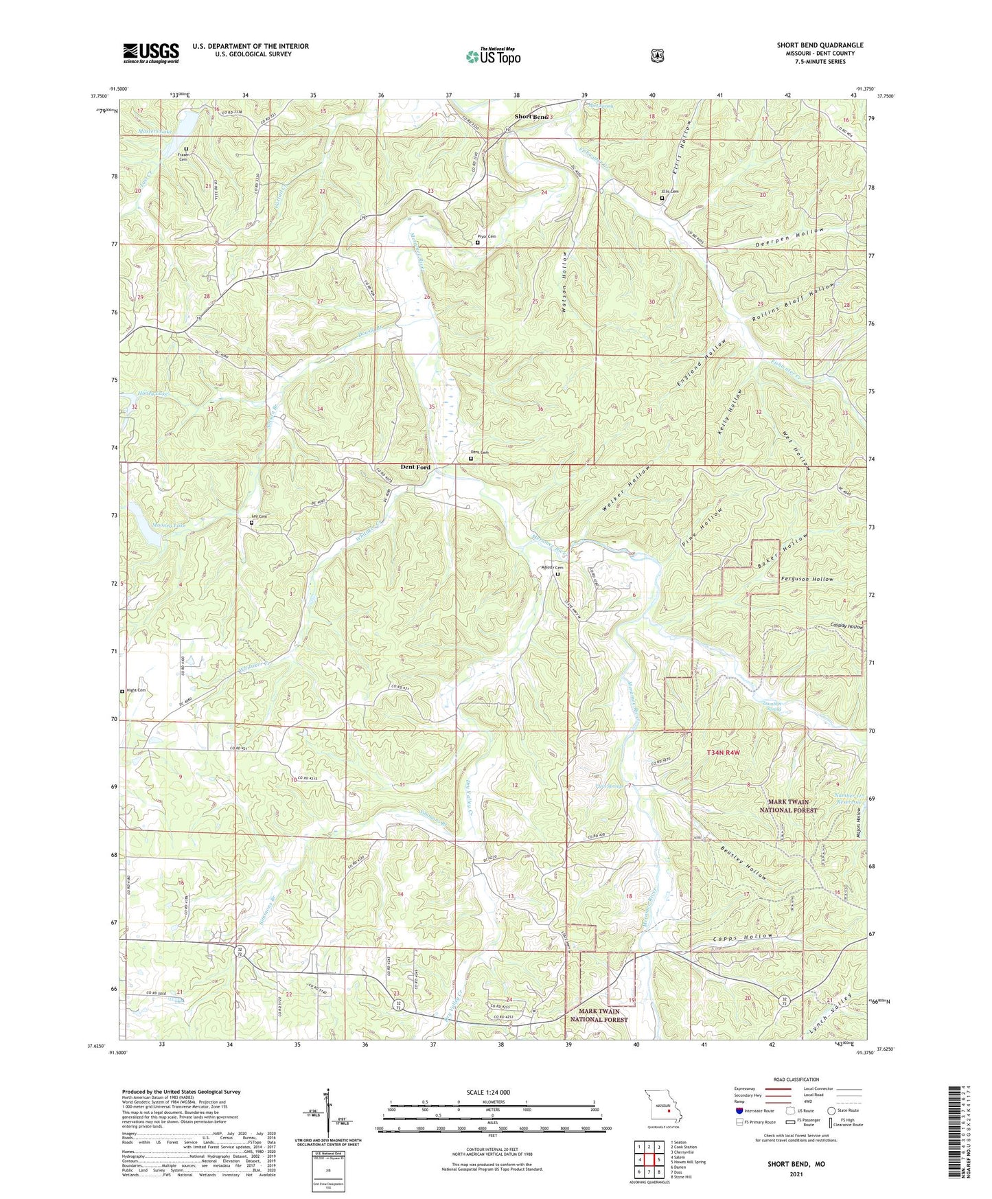
2021 topographic map quadrangle Short Bend in the state of Missouri. Scale: 1:24000. Based on the newly updated USGS 7.5' US Topo map series, this map is in the following counties: Dent. The map contains contour data, water features, and other items you are used to seeing on USGS maps, but also has updated roads and other features. This is the next generation of topographic maps. Printed on high-quality waterproof paper with UV fade-resistant inks.
Quads adjacent to this one:
West: Salem
Northwest: Seaton
North: Cook Station
Northeast: Cherryville
East: Howes Mill Spring
Southeast: Stone Hill
South: Doss
Southwest: Darien
Contains the following named places: Baker Hollow, Beasley Hollow, Capps Hollow, Cassidy Hollow, Deerpen Hollow, Dent Cemetery, Dent Ford, Dowdy Branch, Dry Valley Creek, Ellis Cemetery, Ellis Hollow, England Hollow, Ferguson Hollow, Fishwater Creek, Fishwater School, Fraser Cemetery, Gamblin Spring, Hight Cemetery, Honey Lake, Honey Lake Dam, Hutchins Creek, Kelly Hollow, Kent Chapel, Lay Cemetery, Maledy Cemetery, Maledy Ford, Masters Dam, Masters Lake, Mitchell Dam, Mooney Lake, Mounce, Mount Dyke Baptist Church, Mount Dyke School, Nelson Branch, New Home Church, New Home School, North Crossroads School, North Fairview School, Pine Hollow, Pryor Cemetery, Rollins Bluff Hollow, Short Bend, Simmons Branch, Simmons School, Springers Mill, Township of Short Bend, Township of Spring Creek East, Twin Springs, Union Church, Walker Hollow, Warner Dam, Watson Hollow, Wet Hollow, Whitaker Creek