MyTopo
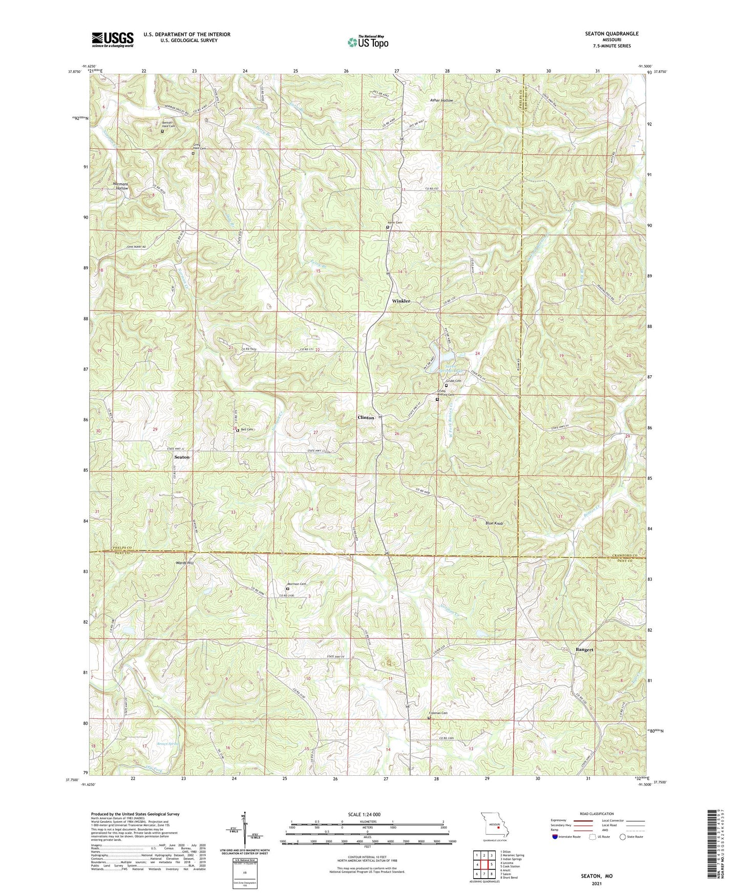
Seaton Missouri US Topo Map
Couldn't load pickup availability
2021 topographic map quadrangle Seaton in the state of Missouri. Scale: 1:24000. Based on the newly updated USGS 7.5' US Topo map series, this map is in the following counties: Phelps, Dent, Crawford. The map contains contour data, water features, and other items you are used to seeing on USGS maps, but also has updated roads and other features. This is the next generation of topographic maps. Printed on high-quality waterproof paper with UV fade-resistant inks.
Quads adjacent to this one:
West: Lecoma
Northwest: Dillon
North: Maramec Spring
Northeast: Indian Springs
East: Cook Station
Southeast: Short Bend
South: Salem
Southwest: Anutt
This map covers the same area as the classic USGS quad with code o37091g5.
Contains the following named places: Asher Cemetery, Austria, Bangert, Bell Cemetery, Benton Creek Mine, Benton-Hale Cemetery, Blue Knob, Blue Mountain Mine, Boscobel, Brady Mine, Bronson Mine, Brown Spring, Clark Mine, Clinton, Clinton Bank School, Condray, Eichorst School, Freeman Cemetery, Greig Hale Cemetery, Grubb Andrew Cemetery, Grubb Cemetery, Hale Branch, Hale School, Hawkins Bank, Hawkins Bank School, Highland Church, Highland School, Kelly Bank Mine, Lay Branch, Metzger Dam, Morrison Cemetery, Nine Sixteen Bank, Norman, Perry Branch, Ryder Lake Dam, Seaton, Seven Springs Lake, Seven Springs Lake Dam, Smith Mine, Stimson Mine, Wards Hill, Watkins School, Winkler, Winkler Mine