MyTopo
Spencerburg Missouri US Topo Map
Couldn't load pickup availability
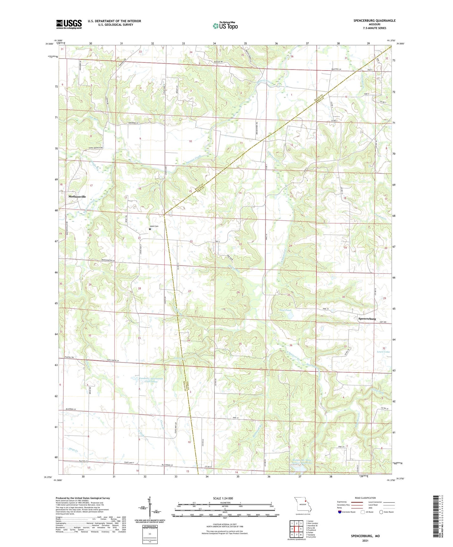
2021 topographic map quadrangle Spencerburg in the state of Missouri. Scale: 1:24000. Based on the newly updated USGS 7.5' US Topo map series, this map is in the following counties: Pike, Ralls. The map contains contour data, water features, and other items you are used to seeing on USGS maps, but also has updated roads and other features. This is the next generation of topographic maps. Printed on high-quality waterproof paper with UV fade-resistant inks.
Quads adjacent to this one:
West: Perry NE
Northwest: Center
North: New London
Northeast: Hannibal SE
East: Frankford
Southeast: Curryville
South: Vandalia
Southwest: Farber
Contains the following named places: Adiel Cemetery, Adiel Church, Brice School, Bridgewater School, Clifty Fork, Coon Creek, Crigler Branch, Denny Run, East Fork, Elk Lick Springs, Elk Lick Springs Post Office, Hays Creek Church, Hippo Branch, Jug Run, Lewis Lake, Lewis Lake Dam, Lick School, Madisonville, Madisonville School, McDowell Branch, Neal Pond, Pleasant Hill Church, Rose School, Scott School, Seely School, South Spencer Creek, Spencerburg, Township of Spencer, Vandalia Lake Dam, Vandalia Sportsman Club Lakes, Weldon H. 'Pete' Steiner Reservoir