MyTopo
Spokane Missouri US Topo Map
Couldn't load pickup availability
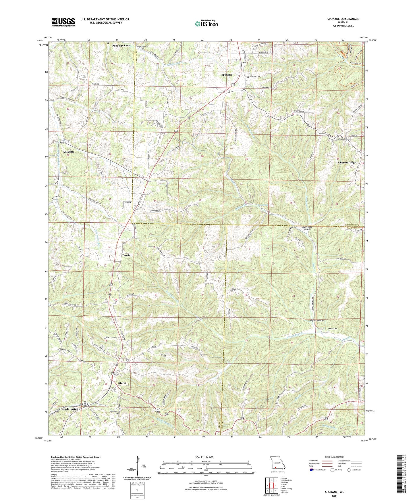
2021 topographic map quadrangle Spokane in the state of Missouri. Scale: 1:24000. Based on the newly updated USGS 7.5' US Topo map series, this map is in the following counties: Christian, Stone, Taney. The map contains contour data, water features, and other items you are used to seeing on USGS maps, but also has updated roads and other features. This is the next generation of topographic maps. Printed on high-quality waterproof paper with UV fade-resistant inks.
Quads adjacent to this one:
West: Galena
Northwest: Hurley
North: Highlandville
Northeast: Selmore
East: Day
Southeast: Branson
South: Garber
Southwest: Reeds Spring
Contains the following named places: Abesville, Antioch, Antioch School, Chestnut Ridge, Chestnutridge, Dry Branch, Eisenhour Church, Highlandville Fire Protection District Station 2, Hollow Creek, Hurricane Creek, Hurricane Hollow, Keystone Church, Keystone School, Pignut Hollow, Ponce de Leon Post Office, Reno, Reno Spring, Schupbach Cemetery, Seaton Cemetery, Shepherd of the Hills Camp, Southern Stone County Fire Protection District Station 8, Spokane, Spokane Census Designated Place, Spokane Post Office, Spokane School, Stults Cemetery, Stutts, Tauria, Township of South Galloway, West Fork Bear Creek, ZIP Codes: 65728, 65754