MyTopo
Stanberry Missouri US Topo Map
Couldn't load pickup availability
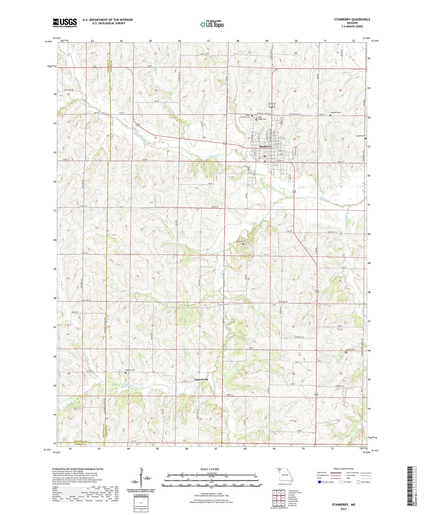
2021 topographic map quadrangle Stanberry in the state of Missouri. Scale: 1:24000. Based on the newly updated USGS 7.5' US Topo map series, this map is in the following counties: Gentry, Nodaway, Andrew. The map contains contour data, water features, and other items you are used to seeing on USGS maps, but also has updated roads and other features. This is the next generation of topographic maps. Printed on high-quality waterproof paper with UV fade-resistant inks.
Quads adjacent to this one:
West: Guilford
Northwest: Ravenwood
North: Alanthus Grove
Northeast: Gentry
East: Darlington
Southeast: Ford City
South: King City
Southwest: Whitesville
Contains the following named places: Beggs School, City of Stanberry, Cogdill School, Cooper Cemetery, Cranor Cemetery, Crosswhite School, Floyd School, High Ridge Cemetery, Island City, Island City School, Island Creek, King Branch, Lafayette School, Meeker Cemetery, Moccasin Creek, Mount Pleasant, Mount Pleasant School, Stanberry, Stanberry Elementary School, Stanberry High School, Stanberry Post Office, Stanberry Rural Fire District, Star School, Turkey Creek, Walnut Fork, ZIP Code: 64489