MyTopo
Whitesville Missouri US Topo Map
Couldn't load pickup availability
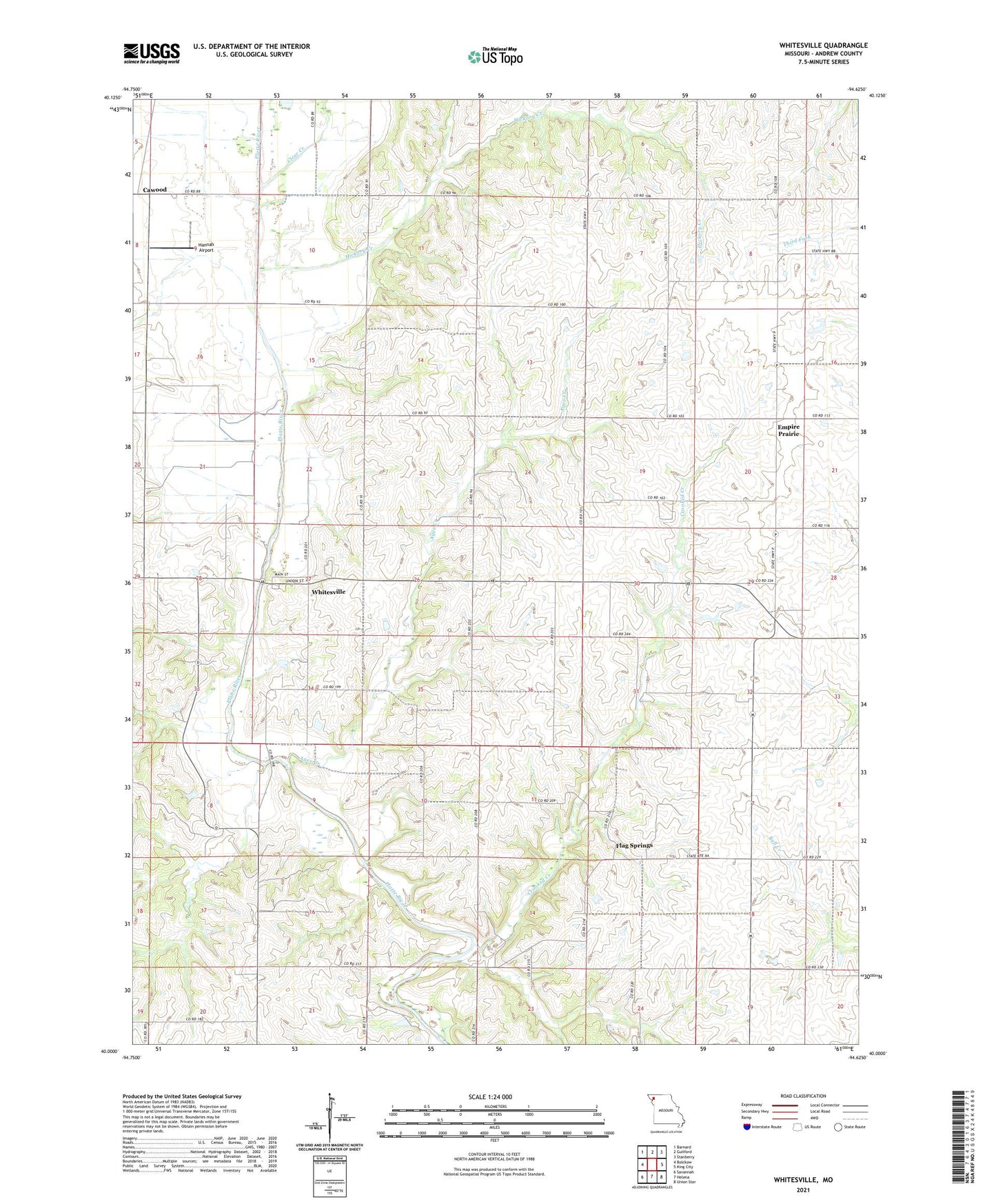
2021 topographic map quadrangle Whitesville in the state of Missouri. Scale: 1:24000. Based on the newly updated USGS 7.5' US Topo map series, this map is in the following counties: Andrew. The map contains contour data, water features, and other items you are used to seeing on USGS maps, but also has updated roads and other features. This is the next generation of topographic maps. Printed on high-quality waterproof paper with UV fade-resistant inks.
Quads adjacent to this one:
West: Bolckow
Northwest: Barnard
North: Guilford
Northeast: Stanberry
East: King City
Southeast: Union Star
South: Helena
Southwest: Savannah
This map covers the same area as the classic USGS quad with code o40094a6.
Contains the following named places: Agee Creek, Bennywood School, Blue School, Bonham School, Cawood, Clear Creek, Crooked Creek, Elrod Mill State Access Area, Empire Prairie, Empire School, Flag Springs, Flag Springs School, Hannah Airport, Hickory Creek, Hickory Creek School, High Prairie School, Miller School, Murphy School, Township of Empire, Township of Platte, Whitesville, ZIP Code: 64480