MyTopo
Sweden Missouri US Topo Map
Couldn't load pickup availability
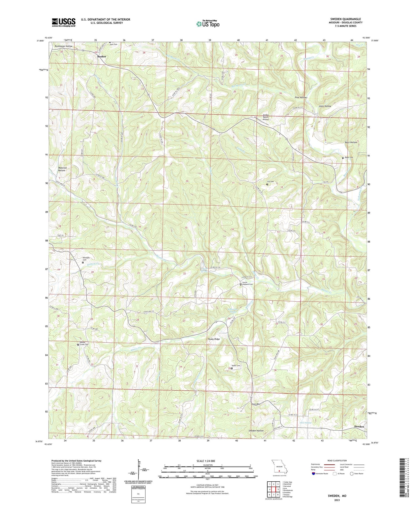
2021 topographic map quadrangle Sweden in the state of Missouri. Scale: 1:24000. Based on the newly updated USGS 7.5' US Topo map series, this map is in the following counties: Douglas. The map contains contour data, water features, and other items you are used to seeing on USGS maps, but also has updated roads and other features. This is the next generation of topographic maps. Printed on high-quality waterproof paper with UV fade-resistant inks.
Quads adjacent to this one:
West: Ava
Northwest: Cedar Gap
North: Mansfield
Northeast: Norwood
East: Brushyknob
Southeast: Rockbridge
South: Wasola
Southwest: Smallett
Contains the following named places: Arnika Ranch Airport, Barn Hollow, Basher, Bill Macks Creek, Billingsly Cemetery, Blackoak Flat Church, Blackoak Flat School, Camp Creek, Coy Cemetery, Crystal Spring, Dicky Creek, Dobbs Cemetery, Dry Creek, Elliott School, Henry Creek, Hoffmeister Spring, Hunter School, Idumea, Idumea Post Office, Iron Mountain, Jacks Fork, Josie Hollow, Larissa, Larissa Post Office, Laurie Hubbard Cemetery, Mount Nebo School, Olive Springs, Peaky Ridge, Peavine School, Pine Hollow, Pine Park School, Roper Cemetery, Saints Church, Star Chapel, Star School, Sweden, Sweden Church, Sweden Post Office, Tarbutton Creek, Township of Boone, Turkey Creek, Turkey Creek Church, Watered Hollow, West Liberty School, Whites Creek, Whites Creek Cemetery, Whites Creek School, Wildcat Creek