MyTopo
Tiff Missouri US Topo Map
Couldn't load pickup availability
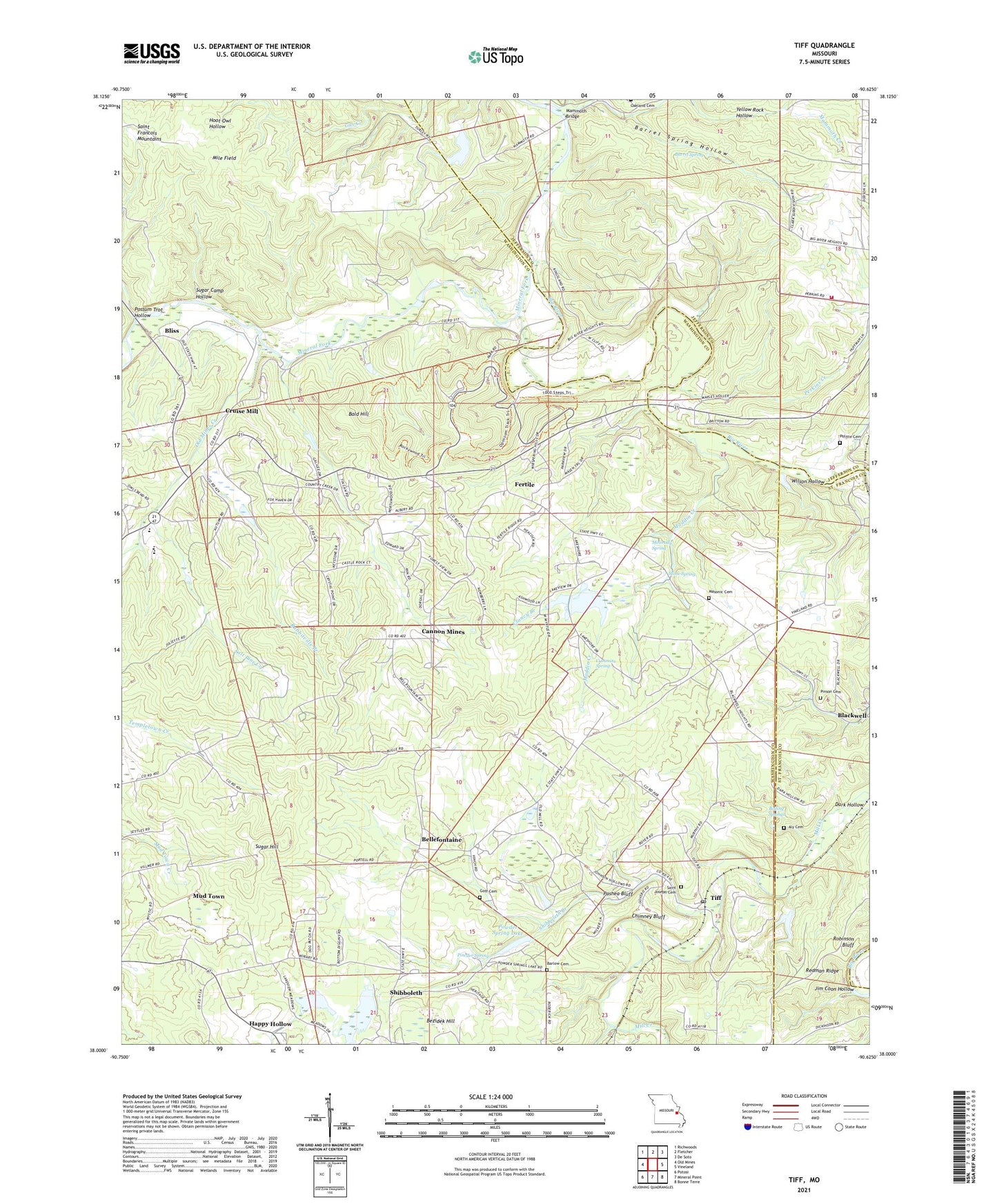
2021 topographic map quadrangle Tiff in the state of Missouri. Scale: 1:24000. Based on the newly updated USGS 7.5' US Topo map series, this map is in the following counties: Washington, Jefferson, St. Francois. The map contains contour data, water features, and other items you are used to seeing on USGS maps, but also has updated roads and other features. This is the next generation of topographic maps. Printed on high-quality waterproof paper with UV fade-resistant inks.
Quads adjacent to this one:
West: Old Mines
Northwest: Richwoods
North: Fletcher
Northeast: De Soto
East: Vineland
Southeast: Bonne Terre
South: Mineral Point
Southwest: Potosi
This map covers the same area as the classic USGS quad with code o38090a6.
Contains the following named places: Aly Cemetery, Bald Hill, Barlow Cemetery, Barrel Spring, Barrel Spring Hollow, Baryties, Baryties School, Belle Fountain School, Bellefontaine, Bellefontaine School, Bezidek Hill, Bezidek Hill Lead Diggings, Black Hill Lead Diggings, Blackwell Mine Dam, Blackwell Pond Dam, Bliss, Bliss School, Block Lead Diggings, Boiling Springs, Bottom Diggins Dam, Bottom Lead Diggings, Cadet Creek, Cadet Number 2 Dam, Camp Ne-O-Tez, Cannon Mines, Carter Lake Dam, Chimney Bluff, Clancy Branch, Cruise Mill, Cruise School, Cummins Spring, Dark Hollow, De Soto Rural Fire Protection District Station 5, Dorlac Lake Dam, Douglas School, Dresser Minerals Section 19 Dam, Dresser Minerals Section 24 Dam, Dresser Number 11 Tailings Pond Dam, Dresser Number 4 Dam, Eshbaugh-Martin Dam, Fertile, Fraction Lead Diggings, Goff Cemetery, Hahn Lake Dam, Happy Hollow, Jim Coon Hollow, Kingston School, Lower Dresser Number 4 Dam, Maddens Richwoods, Maddin Creek, Mammoth Bridge, Mammoth Creek, Maplewood School, Masonic Cemetery, McGrady Spring, McGradys Diggings, Mile Field, Mine Shibboleth, Mineral Fork, Mud Town, Mudtown Lead Diggings, New Dresser Number 4 Dam, NL Industries Tiff Dam, Number 6 Washing Plant Reservoir, Oakland Church, Old Mines Creek, Old Mines Tailings Dam, Parker Creek, Pashea Bluff, Perkins Creek, Pinson Cemetery, Politte Cemetery, Possum Trot Hollow, Powder Spring, Powder Spring Lake, Powder Spring Lake Dam, Prairie Lead Diggings, Rabbitville, Rabbitville Branch, Redman Ridge, Robinson Bluff, Saint Joseph Cemetery, Saint Joseph School, Salt Pine Creek, Shibboleth, Shibboleth Branch, Stage Ford, Stone Spring, Sugar Camp Hollow, Sugar Hill, Sun Mine Dam, Theabeau Town, Thunderbolt C C C Camp, Tiff, Tiff Post Office, Tiff School, Township of Kingston, Township of Union, Washington Lookout Tower, Washington State Park, Whaley-Scott Lake, Whaley-Scott Mine Dam, Wilson Hollow, ZIP Codes: 63030, 63626, 63630, 63674