MyTopo
Tiffin Missouri US Topo Map
Couldn't load pickup availability
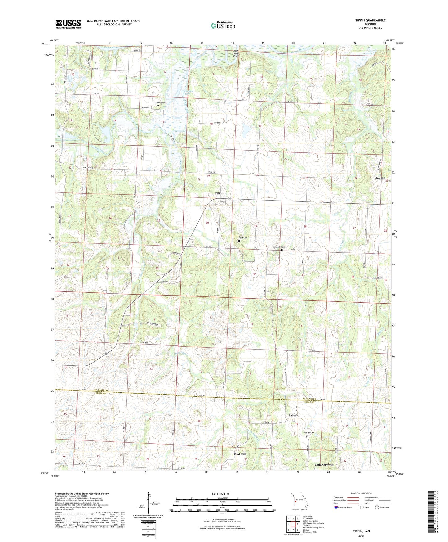
2021 topographic map quadrangle Tiffin in the state of Missouri. Scale: 1:24000. Based on the newly updated USGS 7.5' US Topo map series, this map is in the following counties: St. Clair, Cedar. The map contains contour data, water features, and other items you are used to seeing on USGS maps, but also has updated roads and other features. This is the next generation of topographic maps. Printed on high-quality waterproof paper with UV fade-resistant inks.
Quads adjacent to this one:
West: El Dorado Springs North
Northwest: Rockville
North: Taberville
Northeast: Monegaw Springs
East: Roscoe
Southeast: Caplinger Mills
South: Filley
Southwest: El Dorado Springs South
Contains the following named places: Arrarat School, Blue Ridge School, Bowling Green School, Cedar Springs School, Clear Creek, Coal Hill, Ebb, Ebb Post Office, Glendale School, Graham School, Horseshoe Lake, Kennerly Cemetery, Landers Cemetery, Lebeck, Light and Life Church Camp, Little Clear Creek, Oyer Hill, Pape, Pape Church, Preston Cemetery, Rock House Bluff, Ruark School, Snyder School, Speedwell Church, Tiffin, Township of East Speedwell, Township of Speedwell, Union Point Cemetery, Union Point School