MyTopo
Vandalia Lake Missouri US Topo Map
Couldn't load pickup availability
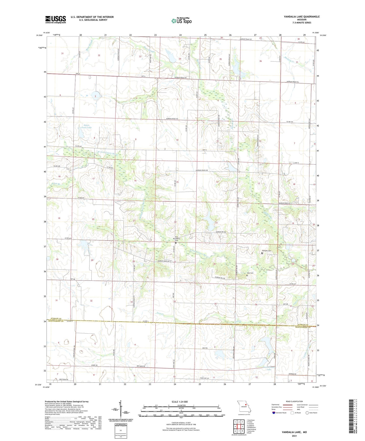
2021 topographic map quadrangle Vandalia Lake in the state of Missouri. Scale: 1:24000. Based on the newly updated USGS 7.5' US Topo map series, this map is in the following counties: Audrain, Montgomery. The map contains contour data, water features, and other items you are used to seeing on USGS maps, but also has updated roads and other features. This is the next generation of topographic maps. Printed on high-quality waterproof paper with UV fade-resistant inks.
Quads adjacent to this one:
West: Laddonia
Northwest: Hutchison
North: Farber
Northeast: Vandalia
East: Middletown
Southeast: Buell
South: Wellsville
Southwest: Martinsburg
Contains the following named places: Barneyville Post Office, Bear Slough, Becker Lake Dam, Beshears Lake Dam, Black School, Cornett School, Culiver, Deichman Lake Dam - North, Deichman Lake Dam - South, Deichman Lake Dam - West, Edwards Cemetery, Elmer Foree Lake, Fike Cemetery, Foree Lake Dam, Fred Wenzel Lake, Hall School, Hammett Lake Dam, Hickory Creek, Hickory Grove School, Johns Branch, Mount Olivet Church, New Providence Cemetery, Pleasant Plains School, Rices Corner, Robertson Dam, Swope School, Township of Cuivre, Vandalia Community Lake, Vandalia Community Lake Dam, Vandalia Lake, West Cuivre Baptist Church