MyTopo
Vera Missouri US Topo Map
Couldn't load pickup availability
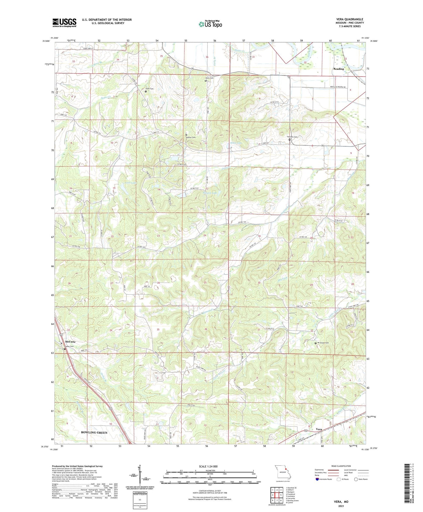
2021 topographic map quadrangle Vera in the state of Missouri. Scale: 1:24000. Based on the newly updated USGS 7.5' US Topo map series, this map is in the following counties: Pike. The map contains contour data, water features, and other items you are used to seeing on USGS maps, but also has updated roads and other features. This is the next generation of topographic maps. Printed on high-quality waterproof paper with UV fade-resistant inks.
Quads adjacent to this one:
West: Frankford
Northwest: Hannibal SE
North: Ashburn
Northeast: Rockport
East: Louisiana
Southeast: Cyrene
South: Bowling Green
Southwest: Curryville
Contains the following named places: Authur Cemetery, Bryson School, Cains Creek, Dry Fork, Early Cemetery, Ebenezer School, Euell Cemetery, Fairview Cemetery, Gailey Cemetery, Grassy Creek Church, Grassy Creek Methodist Church, Grassy Creek Presbyterian Church, Grove School, IMR Corporation Section 11 Dam, Love Lake, Love Lake Dam, Mc Elwee Cemetery, McCune, Pfautch Lake, Pfautch Lake Dam, Pleasant Valley School, Reading, Rural Grove School, South Horn Branch, Staton Dam, Sugar Creek, Sugar Creek School, Three Churches, Vera, Vine Hill School, Walnut Grove Church, Watson School, White Lake, White Lake Dam, Wilhite Dam, Wooten School