MyTopo
Washington West Missouri US Topo Map
Couldn't load pickup availability
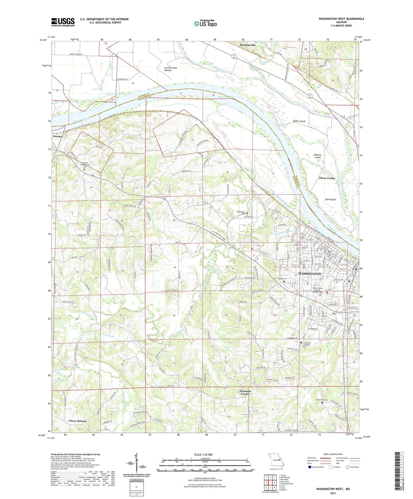
2021 topographic map quadrangle Washington West in the state of Missouri. Scale: 1:24000. Based on the newly updated USGS 7.5' US Topo map series, this map is in the following counties: Franklin, Warren. The map contains contour data, water features, and other items you are used to seeing on USGS maps, but also has updated roads and other features. This is the next generation of topographic maps. Printed on high-quality waterproof paper with UV fade-resistant inks.
Quads adjacent to this one:
West: New Haven
Northwest: Treloar
North: Marthasville
Northeast: New Melle
East: Washington East
Southeast: Moselle
South: Union
Southwest: Leslie
Contains the following named places: Ascension Cemetery, Brushy Creek, City of Washington, Clover Bottom, Daniel Boone Monument, Dewey, Dundee, East Island, Evangelical Lutheran Immanuel Church, Faith Lutheran Church, Fifth Street Elementary School, First Assembly of God, First Baptist Church, First Christian Church, First Church of Christian Scientist, First Wesleyan Church, Fourmile Corner, Franklin County Country Club, Hillsboro School, Immanuel Lutheran Cemetery, Immanuel Lutheran School, Krog Park, Lake Creek, Lions Lake, Lions Lake Dam, Living Bread Fellowship Church, Long Branch, Lost Umlaut Farm Airport, Mercy Hospital Washington, Miller Island, Newport Presbyterian Cemetery, Newport Presbyterian Church, Newport School, Our Lady of Lourdes Catholic Church, Our Lady of Lourdes Catholic School, Patients First Health Care Center, Peace Lutheran Church, Peers Slough, Rock Hill School, Saint Anne School, Saint Ann's Catholic Church, Saint Francis Borgia Catholic Cemetery, Saint Francis Borgia Catholic Church, Saint Francis Borgia Grade School, Saint Francis Borgia Regional High School, Saint Francis Borgia School, Saint John Mercy Medical Building, Saint Johns Creek, Saint Johns Island, Saint Peter School, Saint Peter United Church of Christ, Sappington Cemetery, Slaughter Branch, The Church of Jesus Christ of Latter Day Saints, Township of Saint Johns, Township of Washington, Tuque Creek, Washington, Washington Amtrak Railroad Station, Washington Area Ambulance District Station, Washington City Hall, Washington Fire Department Station 1, Washington Fire Department Station 3, Washington Fire Department Training, Washington High School, Washington Historical Society Museum, Washington Middle School, Washington Montessori School, Washington Police Department, Washington Post Office, Washington Post Office Downtown Station, Washington Public Library, Washington Water Storage Tank, Washington Water Tower, Washington West Elementary School, Watkins Island, Whisky Creek, Wildey Cemetery, Ziegenmeyers School, ZIP Code: 63090