MyTopo
Weston Missouri US Topo Map
Couldn't load pickup availability
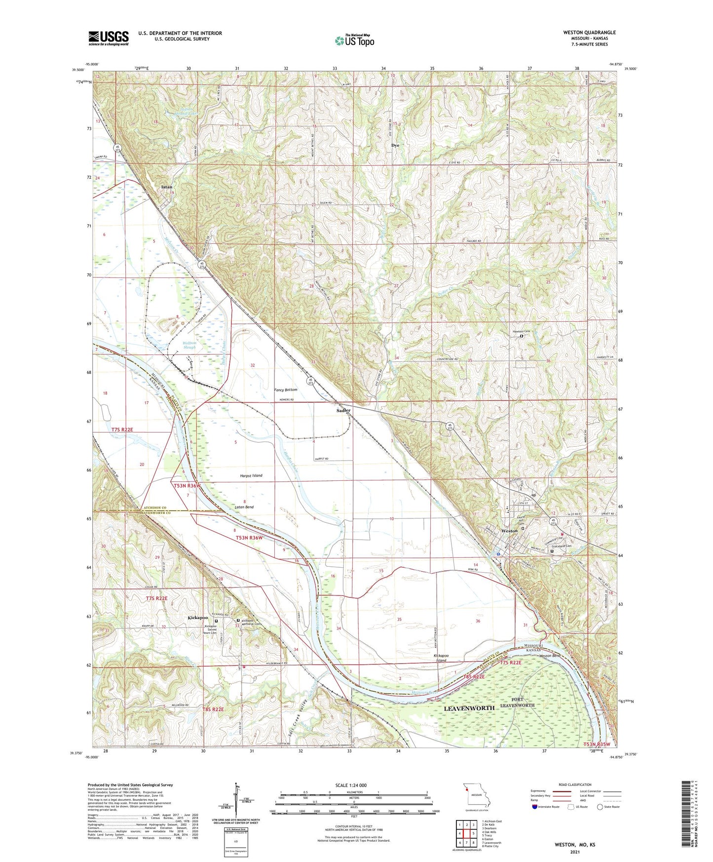
2021 topographic map quadrangle Weston in the states of Missouri, Kansas. Scale: 1:24000. Based on the newly updated USGS 7.5' US Topo map series, this map is in the following counties: Platte, Leavenworth, Atchison. The map contains contour data, water features, and other items you are used to seeing on USGS maps, but also has updated roads and other features. This is the next generation of topographic maps. Printed on high-quality waterproof paper with UV fade-resistant inks.
Quads adjacent to this one:
West: Oak Mills
Northwest: Atchison East
North: De Kalb
Northeast: Dearborn
East: Tracy
Southeast: Platte City
South: Leavenworth
Southwest: Easton
This map covers the same area as the classic USGS quad with code o39094d8.
Contains the following named places: Bear Creek, Benner Branch, Bless Park, Brills Creek, Burrus School, Central Elementary School, City of Weston, Coffin School, Cook School, Coxe School, Dye, Fancy Bottom, Fancy Bottoms School, Fort Leavenworth Disciplinary Barracks, Graceland Cemetery, Harpst Chute, Harpst Island, Hawkins Cemetery, Iatan, Iatan Pond, Indian Mound Lakes, Kickapoo, Kickapoo Island, Kickapoo Memorial Cemetery, Kickapoo Sacred Heart Cemetery, Kickapoo Township Fire Department Station 2, Latan Bend, Laurel Hill Cemetery, Mission Creek, Mount Bethel Church, Neirs Slough, Pedee Creek, Platte Valley School, Plum Creek, Sacred Heart Catholic Church, Sadler, Salem Church, Salt Creek, Salt Creek Valley, Township of Marshall, Township of Weston, Village of Iatan, Wells Branch, Wellson Slough, West Platte Fire Protection District, West Platte High School, Weston, Weston Bend, Weston Bend State Park, Weston Police Department, Weston Post Office, Wilson Lake, Wilson Lake Dam, Wrights Slough, ZIP Code: 64098