MyTopo
Tracy Missouri US Topo Map
Couldn't load pickup availability
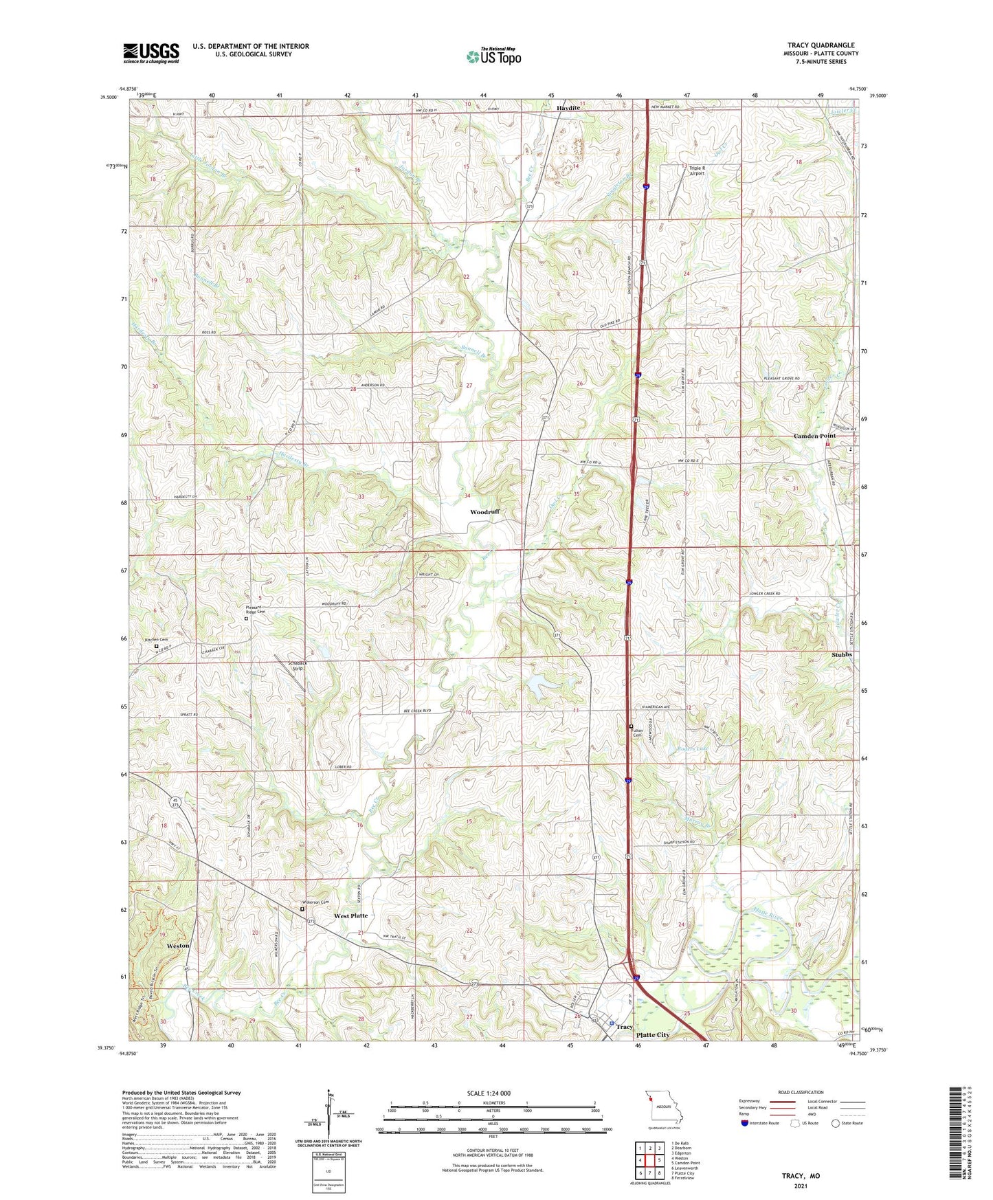
2021 topographic map quadrangle Tracy in the state of Missouri. Scale: 1:24000. Based on the newly updated USGS 7.5' US Topo map series, this map is in the following counties: Platte. The map contains contour data, water features, and other items you are used to seeing on USGS maps, but also has updated roads and other features. This is the next generation of topographic maps. Printed on high-quality waterproof paper with UV fade-resistant inks.
Quads adjacent to this one:
West: Weston
Northwest: De Kalb
North: Dearborn
Northeast: Edgerton
East: Camden Point
Southeast: Ferrelview
South: Platte City
Southwest: Leavenworth
This map covers the same area as the classic USGS quad with code o39094d7.
Contains the following named places: Bonnell Branch, Camden Point Fire Department, City of Tracy, Duncan, Elm Grove School, Flintlock Church, Flintlock Field Airport, Folck Lake, Folck Lake Dam, Fulton Cemetery, Hardesty Branch, Haydite, Hazelwood School, Hiatt Lake, Hiatt Lake Dam, Jordan Branch, Jowler Creek, Kitchen Cemetery, Little Jordan Branch, Louise's Strip, Murray Branch, North Platte Airpark, North Platte Elementary School, Owl Creek, Platte County, Pleasant Ridge Baptist Church, Pleasant Ridge Cemetery, Pleasant Ridge School, Quinn School, Rogers Lake, Rogers Lake Dam, Schaback Strip, Settles Station, Singleton Branch, Stubbs, Swamp School, Township of Fair, Tracy, Tracy Police Department, Triple R Airport, West Platte, Wilkerson Cemetery, Woodland School, Woodruff